

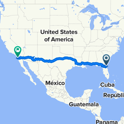
Jacksonville, FL to Savannah, GA
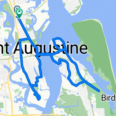
A cycling route starting in Saint Augustine, Florida, United States.
Overview
About this route
- -:--
- Duration
- 325.2 km
- Distance
- 107 m
- Ascent
- 90 m
- Descent
- ---
- Avg. speed
- ---
- Max. altitude

Route quality
Waytypes & surfaces along the route
Waytypes
Cycleway
74.8 km
(23 %)
Road
26 km
(8 %)
Surfaces
Paved
146.4 km
(45 %)
Asphalt
104.1 km
(32 %)
Concrete
39 km
(12 %)
Continue with Bikemap
Use, edit, or download this cycling route
You would like to ride Jacksonville, FL to Savannah, GA or customize it for your own trip? Here is what you can do with this Bikemap route:
Free features
- Save this route as favorite or in collections
- Copy & plan your own version of this route
- Split it into stages to create a multi-day tour
- Sync your route with Garmin or Wahoo
Premium features
Free trial for 3 days, or one-time payment. More about Bikemap Premium.
- Navigate this route on iOS & Android
- Export a GPX / KML file of this route
- Create your custom printout (try it for free)
- Download this route for offline navigation
Discover more Premium features.
Get Bikemap PremiumFrom our community
Other popular routes starting in Saint Augustine
 KD ride across america
- Distance
- 4,231.2 km
- Ascent
- 9,332 m
- Descent
- 9,261 m
- Location
- Saint Augustine, Florida, United States
 200 Red Cox Dr, St. Augustine to 133 Lost Beach Ln, Ponte Vedra Beach
- Distance
- 157.5 km
- Ascent
- 261 m
- Descent
- 265 m
- Location
- Saint Augustine, Florida, United States
 US 4
US 4- Distance
- 169.2 km
- Ascent
- 68 m
- Descent
- 66 m
- Location
- Saint Augustine, Florida, United States
 ASW 6-6-2021
- Distance
- 11.3 km
- Ascent
- 30 m
- Descent
- 28 m
- Location
- Saint Augustine, Florida, United States
 N Ponce de Leon Blvd, St. Augustine to W San Carlos Ave, St. Augustine
- Distance
- 21.3 km
- Ascent
- 50 m
- Descent
- 48 m
- Location
- Saint Augustine, Florida, United States
 Los Robles Avenue 1461, St. Augustine to Saint Augustine Boulevard 2640, St. Augustine
- Distance
- 17.7 km
- Ascent
- 16 m
- Descent
- 7 m
- Location
- Saint Augustine, Florida, United States
 Castillo De San Marcos;Vilano; Freedom Park and Back
- Distance
- 17.3 km
- Ascent
- 48 m
- Descent
- 46 m
- Location
- Saint Augustine, Florida, United States
 To Downtown
- Distance
- 2.4 km
- Ascent
- 12 m
- Descent
- 12 m
- Location
- Saint Augustine, Florida, United States
Open it in the app