
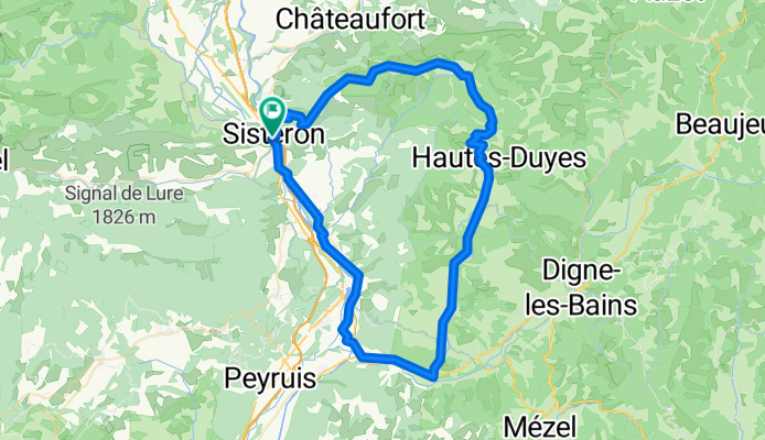
Sisteron, circuit 80 km
A cycling route starting in Sisteron, Provence-Alpes-Côte d'Azur Region, France.
Overview
About this route
- -:--
- Duration
- 80 km
- Distance
- 1,059 m
- Ascent
- 1,059 m
- Descent
- ---
- Avg. speed
- ---
- Max. altitude
Route quality
Waytypes & surfaces along the route
Waytypes
Road
51.2 km
(64 %)
Quiet road
9.6 km
(12 %)
Surfaces
Paved
61.6 km
(77 %)
Asphalt
61.6 km
(77 %)
Undefined
18.4 km
(23 %)
Continue with Bikemap
Use, edit, or download this cycling route
You would like to ride Sisteron, circuit 80 km or customize it for your own trip? Here is what you can do with this Bikemap route:
Free features
- Save this route as favorite or in collections
- Copy & plan your own version of this route
- Sync your route with Garmin or Wahoo
Premium features
Free trial for 3 days, or one-time payment. More about Bikemap Premium.
- Navigate this route on iOS & Android
- Export a GPX / KML file of this route
- Create your custom printout (try it for free)
- Download this route for offline navigation
Discover more Premium features.
Get Bikemap PremiumFrom our community
Other popular routes starting in Sisteron
 Durance - Buech - Eygues
- Distance
- 306.8 km
- Ascent
- 1,098 m
- Descent
- 1,111 m
- Location
- Sisteron, Provence-Alpes-Côte d'Azur Region, France
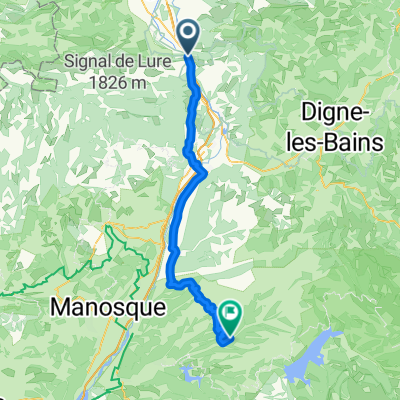 From Sisteron to Allemagne-en-Provence
- Distance
- 67.8 km
- Ascent
- 1,072 m
- Descent
- 1,133 m
- Location
- Sisteron, Provence-Alpes-Côte d'Azur Region, France
 4. Tag Sisteron - Moustiers
- Distance
- 88.8 km
- Ascent
- 722 m
- Descent
- 613 m
- Location
- Sisteron, Provence-Alpes-Côte d'Azur Region, France
 France Ultime : Avignon - Sisteron
- Distance
- 196.1 km
- Ascent
- 2,816 m
- Descent
- 3,223 m
- Location
- Sisteron, Provence-Alpes-Côte d'Azur Region, France
 Sisteron, circuit 80 km
- Distance
- 80 km
- Ascent
- 1,059 m
- Descent
- 1,059 m
- Location
- Sisteron, Provence-Alpes-Côte d'Azur Region, France
 Sisteron - Circle to Peipin
- Distance
- 14.8 km
- Ascent
- 145 m
- Descent
- 138 m
- Location
- Sisteron, Provence-Alpes-Côte d'Azur Region, France
 Sisteron - Circle to Claret
- Distance
- 54.3 km
- Ascent
- 798 m
- Descent
- 797 m
- Location
- Sisteron, Provence-Alpes-Côte d'Azur Region, France
 Gap to Digne to Château-Arnoux-Saint-Auban
- Distance
- 73.1 km
- Ascent
- 344 m
- Descent
- 376 m
- Location
- Sisteron, Provence-Alpes-Côte d'Azur Region, France
Open it in the app