

Schöpfungsroute Abwinden_St.Lorenz
A cycling route starting in Asten, Upper Austria, Austria.
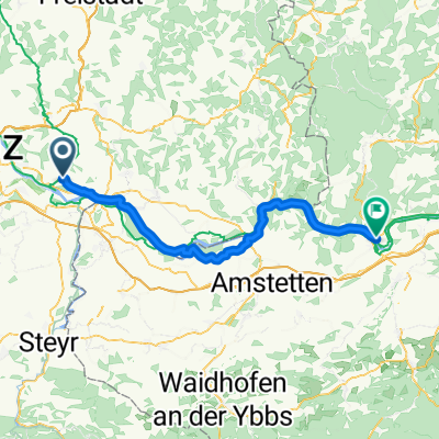
Overview
About this route
- -:--
- Duration
- 135.6 km
- Distance
- 189 m
- Ascent
- 235 m
- Descent
- ---
- Avg. speed
- ---
- Max. altitude

Route quality
Waytypes & surfaces along the route
Waytypes
Track
27.1 km
(20 %)
Road
23 km
(17 %)
Surfaces
Paved
99 km
(73 %)
Unpaved
14.9 km
(11 %)
Asphalt
89.5 km
(66 %)
Concrete
8.1 km
(6 %)
Route highlights
Points of interest along the route
Point of interest after 0 km
Standort 13
Point of interest after 10.6 km
Standort 14:
Point of interest after 20.7 km
Standort 15
Point of interest after 35.7 km
Standort 16
Point of interest after 48.7 km
Standort 18
Point of interest after 57.3 km
Standort 17
Point of interest after 73.2 km
Standort 19
Point of interest after 87.1 km
Standort 20 Sarling
Point of interest after 98.3 km
Standort 21
Point of interest after 110.6 km
Standort22
Point of interest after 121.2 km
Standort 23
Point of interest after 135.6 km
Standort 23A
Continue with Bikemap
Use, edit, or download this cycling route
You would like to ride Schöpfungsroute Abwinden_St.Lorenz or customize it for your own trip? Here is what you can do with this Bikemap route:
Free features
- Save this route as favorite or in collections
- Copy & plan your own version of this route
- Split it into stages to create a multi-day tour
- Sync your route with Garmin or Wahoo
Premium features
Free trial for 3 days, or one-time payment. More about Bikemap Premium.
- Navigate this route on iOS & Android
- Export a GPX / KML file of this route
- Create your custom printout (try it for free)
- Download this route for offline navigation
Discover more Premium features.
Get Bikemap PremiumFrom our community
Other popular routes starting in Asten
 Wolfsjagerbiketour
- Distance
- 29.6 km
- Ascent
- 179 m
- Descent
- 187 m
- Location
- Asten, Upper Austria, Austria
 Asten - Ybbs an der Donau
- Distance
- 65.7 km
- Ascent
- 362 m
- Descent
- 387 m
- Location
- Asten, Upper Austria, Austria
 Tillysburgstraße nach Tillysburgstraße
- Distance
- 15.4 km
- Ascent
- 111 m
- Descent
- 112 m
- Location
- Asten, Upper Austria, Austria
 Asten-Engelhartszell-Linz 184km
- Distance
- 184.5 km
- Ascent
- 1,894 m
- Descent
- 1,896 m
- Location
- Asten, Upper Austria, Austria
 Pfenningberg Lang
- Distance
- 42.9 km
- Ascent
- 680 m
- Descent
- 665 m
- Location
- Asten, Upper Austria, Austria
 Schöpfungsroute Abwinden_St.Lorenz
- Distance
- 135.6 km
- Ascent
- 189 m
- Descent
- 235 m
- Location
- Asten, Upper Austria, Austria
 Pegelweg, Luftenberg an der Donau to Papa-Gruber-Platz, Langenstein
- Distance
- 4 km
- Ascent
- 13 m
- Descent
- 13 m
- Location
- Asten, Upper Austria, Austria
 Luftenberg an der Donau nach Panholzerweg, Linz
- Distance
- 35.7 km
- Ascent
- 95 m
- Descent
- 91 m
- Location
- Asten, Upper Austria, Austria
Open it in the app