

Final BIM BIM YAMAN
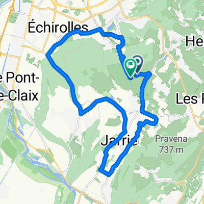
A cycling route starting in Jarrie, Auvergne-Rhône-Alpes, France.
Overview
About this route
- -:--
- Duration
- 295.7 km
- Distance
- 3,552 m
- Ascent
- 3,145 m
- Descent
- ---
- Avg. speed
- ---
- Max. altitude
Route quality
Waytypes & surfaces along the route
Waytypes
Busy road
178.3 km
(60 %)
Road
77.2 km
(26 %)
Surfaces
Paved
165.9 km
(56 %)
Unpaved
2.4 km
(<1 %)
Asphalt
165.9 km
(56 %)
Unpaved (undefined)
1.6 km
(<1 %)
Route highlights
Points of interest along the route
Accommodation after 43.4 km
Accommodation after 108.5 km
Accommodation after 192.6 km
Continue with Bikemap
Use, edit, or download this cycling route
You would like to ride Final BIM BIM YAMAN or customize it for your own trip? Here is what you can do with this Bikemap route:
Free features
- Save this route as favorite or in collections
- Copy & plan your own version of this route
- Split it into stages to create a multi-day tour
- Sync your route with Garmin or Wahoo
Premium features
Free trial for 3 days, or one-time payment. More about Bikemap Premium.
- Navigate this route on iOS & Android
- Export a GPX / KML file of this route
- Create your custom printout (try it for free)
- Download this route for offline navigation
Discover more Premium features.
Get Bikemap PremiumFrom our community
Other popular routes starting in Jarrie
 Jarrie à Chemin Ferré, Jarrie
- Distance
- 7.2 km
- Ascent
- 214 m
- Descent
- 220 m
- Location
- Jarrie, Auvergne-Rhône-Alpes, France
 Final BIM BIM YAMAN
- Distance
- 295.7 km
- Ascent
- 3,552 m
- Descent
- 3,145 m
- Location
- Jarrie, Auvergne-Rhône-Alpes, France
 les balcons du vercors
- Distance
- 96.1 km
- Ascent
- 1,559 m
- Descent
- 1,550 m
- Location
- Jarrie, Auvergne-Rhône-Alpes, France
 Rondje Chamrousse
- Distance
- 50.8 km
- Ascent
- 1,493 m
- Descent
- 1,493 m
- Location
- Jarrie, Auvergne-Rhône-Alpes, France
 balcon du vercor
- Distance
- 139.9 km
- Ascent
- 2,258 m
- Descent
- 2,251 m
- Location
- Jarrie, Auvergne-Rhône-Alpes, France
 alpe du grand serre col ornon
- Distance
- 125.3 km
- Ascent
- 1,979 m
- Descent
- 1,981 m
- Location
- Jarrie, Auvergne-Rhône-Alpes, France
 col de sarenne auris
- Distance
- 134.4 km
- Ascent
- 2,261 m
- Descent
- 2,268 m
- Location
- Jarrie, Auvergne-Rhône-Alpes, France
 De Rue de Montavie, Bresson a Rue de Montavie, Bresson
- Distance
- 19.6 km
- Ascent
- 744 m
- Descent
- 712 m
- Location
- Jarrie, Auvergne-Rhône-Alpes, France
Open it in the app