

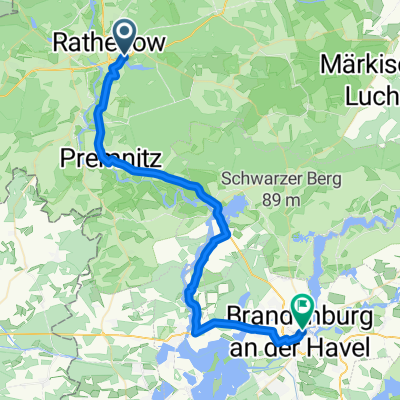
Havelberger Lasso mit Schollener Bier
A cycling route starting in Rathenow, Brandenburg, Germany.
Overview
About this route
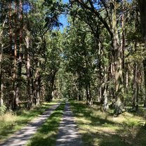
Between the Havel and the Dosse and then also between several beers :)
- -:--
- Duration
- 106.6 km
- Distance
- 110 m
- Ascent
- 110 m
- Descent
- ---
- Avg. speed
- ---
- Max. altitude

Route quality
Waytypes & surfaces along the route
Waytypes
Quiet road
23.4 km
(22 %)
Track
20.2 km
(19 %)
Surfaces
Paved
87.4 km
(82 %)
Unpaved
2.1 km
(2 %)
Asphalt
58.6 km
(55 %)
Concrete
17 km
(16 %)
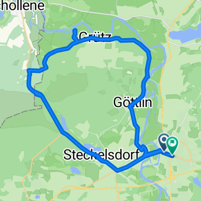
Route highlights
Points of interest along the route
Point of interest after 88.3 km
Neue Brauerei
Continue with Bikemap
Use, edit, or download this cycling route
You would like to ride Havelberger Lasso mit Schollener Bier or customize it for your own trip? Here is what you can do with this Bikemap route:
Free features
- Save this route as favorite or in collections
- Copy & plan your own version of this route
- Split it into stages to create a multi-day tour
- Sync your route with Garmin or Wahoo
Premium features
Free trial for 3 days, or one-time payment. More about Bikemap Premium.
- Navigate this route on iOS & Android
- Export a GPX / KML file of this route
- Create your custom printout (try it for free)
- Download this route for offline navigation
Discover more Premium features.
Get Bikemap PremiumFrom our community
Other popular routes starting in Rathenow
 Rathenow nach Am Schlangenhorst, Nauen
- Distance
- 63.2 km
- Ascent
- 181 m
- Descent
- 176 m
- Location
- Rathenow, Brandenburg, Germany
 Rathenow, südliche Havel (klein)
- Distance
- 28.3 km
- Ascent
- 36 m
- Descent
- 38 m
- Location
- Rathenow, Brandenburg, Germany
 Ackerdörfer-Tour
- Distance
- 74.2 km
- Ascent
- 166 m
- Descent
- 163 m
- Location
- Rathenow, Brandenburg, Germany
 Dunckerplatz, Rathenow nach Altstädtischer Markt, Brandenburg an der Havel
- Distance
- 40.2 km
- Ascent
- 58 m
- Descent
- 49 m
- Location
- Rathenow, Brandenburg, Germany
 Sechs Seen Tour
- Distance
- 64.7 km
- Ascent
- 92 m
- Descent
- 92 m
- Location
- Rathenow, Brandenburg, Germany
 Hohennauener Straße 22, Rathenow nach Hohennauener Straße 22, Rathenow
- Distance
- 20.2 km
- Ascent
- 77 m
- Descent
- 79 m
- Location
- Rathenow, Brandenburg, Germany
 Kirchgang, Rathenow nach Märkischer Platz, Rathenow
- Distance
- 29.4 km
- Ascent
- 441 m
- Descent
- 437 m
- Location
- Rathenow, Brandenburg, Germany
 perm Kietz
- Distance
- 73.3 km
- Ascent
- 99 m
- Descent
- 98 m
- Location
- Rathenow, Brandenburg, Germany
Open it in the app