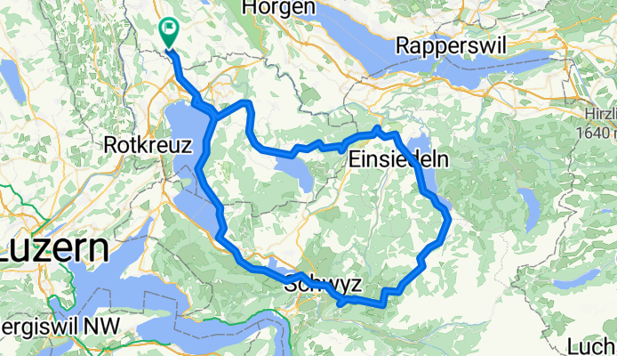
ibergeregg_Gottschalker
A cycling route starting in Knonau, Canton of Zurich, Switzerland.
Overview
About this route
- -:--
- Duration
- 102.5 km
- Distance
- 1,363 m
- Ascent
- 1,357 m
- Descent
- ---
- Avg. speed
- ---
- Avg. speed
Route quality
Waytypes & surfaces along the route
Waytypes
Busy road
63.1 km
(62 %)
Quiet road
15.6 km
(15 %)
Surfaces
Paved
57.4 km
(56 %)
Unpaved
0.5 km
(<1 %)
Asphalt
56.7 km
(55 %)
Paved (undefined)
0.7 km
(<1 %)
Continue with Bikemap
Use, edit, or download this cycling route
You would like to ride ibergeregg_Gottschalker or customize it for your own trip? Here is what you can do with this Bikemap route:
Free features
- Save this route as favorite or in collections
- Copy & plan your own version of this route
- Sync your route with Garmin or Wahoo
Premium features
Free trial for 3 days, or one-time payment. More about Bikemap Premium.
- Navigate this route on iOS & Android
- Export a GPX / KML file of this route
- Create your custom printout (try it for free)
- Download this route for offline navigation
Discover more Premium features.
Get Bikemap PremiumFrom our community
Other popular routes starting in Knonau
- Hagendorn-Glarus-Pragelpass-Hagendorn
- Distance
- 148.7 km
- Ascent
- 1,728 m
- Descent
- 1,727 m
- Location
- Knonau, Canton of Zurich, Switzerland
- ibergeregg_Gottschalker
- Distance
- 102.5 km
- Ascent
- 1,363 m
- Descent
- 1,357 m
- Location
- Knonau, Canton of Zurich, Switzerland
- Knonau Reussthal Rundfahrt Nummer 1
- Distance
- 36.3 km
- Ascent
- 240 m
- Descent
- 242 m
- Location
- Knonau, Canton of Zurich, Switzerland
- Uttenberg - ETH Hönggerberg Rennvelo
- Distance
- 25.1 km
- Ascent
- 350 m
- Descent
- 337 m
- Location
- Knonau, Canton of Zurich, Switzerland
- Albisketten Trails
- Distance
- 69.4 km
- Ascent
- 1,650 m
- Descent
- 1,650 m
- Location
- Knonau, Canton of Zurich, Switzerland
- Bike to work
- Distance
- 29.9 km
- Ascent
- 364 m
- Descent
- 361 m
- Location
- Knonau, Canton of Zurich, Switzerland
- "Rapsroute" René
- Distance
- 19.9 km
- Ascent
- 384 m
- Descent
- 383 m
- Location
- Knonau, Canton of Zurich, Switzerland
- Hagendorn-Klausenpass-Pfäfikon-Hagendorn
- Distance
- 185.5 km
- Ascent
- 2,198 m
- Descent
- 2,195 m
- Location
- Knonau, Canton of Zurich, Switzerland
Open it in the app