

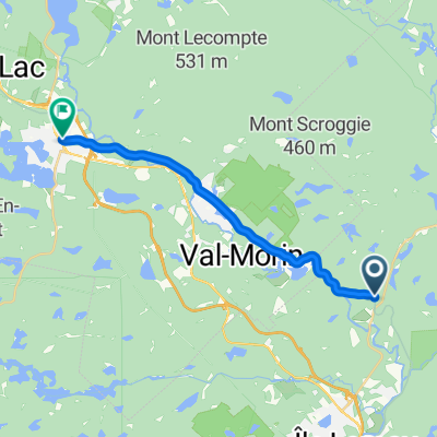
Route 370 (Sainte-Adèle) à Mont-Tremblant
A cycling route starting in Sainte-Adèle, Quebec, Canada.
Overview
About this route
Coming soon
- -:--
- Duration
- 49.9 km
- Distance
- 213 m
- Ascent
- 271 m
- Descent
- ---
- Avg. speed
- ---
- Max. altitude

Continue with Bikemap
Use, edit, or download this cycling route
You would like to ride Route 370 (Sainte-Adèle) à Mont-Tremblant or customize it for your own trip? Here is what you can do with this Bikemap route:
Free features
- Save this route as favorite or in collections
- Copy & plan your own version of this route
- Sync your route with Garmin or Wahoo
Premium features
Free trial for 3 days, or one-time payment. More about Bikemap Premium.
- Navigate this route on iOS & Android
- Export a GPX / KML file of this route
- Create your custom printout (try it for free)
- Download this route for offline navigation
Discover more Premium features.
Get Bikemap PremiumFrom our community
Other popular routes starting in Sainte-Adèle
 250905 Saint Adèle to Saint Jérôme
- Distance
- 34.9 km
- Ascent
- 60 m
- Descent
- 278 m
- Location
- Sainte-Adèle, Quebec, Canada
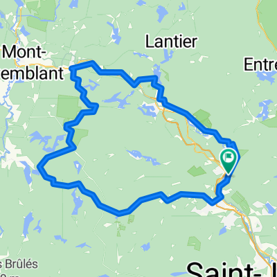
 Estelle Lantier
- Distance
- 93.4 km
- Ascent
- 496 m
- Descent
- 494 m
- Location
- Sainte-Adèle, Quebec, Canada
 SteMarguerite to SteAgathe
- Distance
- 16 km
- Ascent
- 152 m
- Descent
- 60 m
- Location
- Sainte-Adèle, Quebec, Canada
 Route 370 (Sainte-Adèle) à Mont-Tremblant
- Distance
- 49.9 km
- Ascent
- 213 m
- Descent
- 271 m
- Location
- Sainte-Adèle, Quebec, Canada
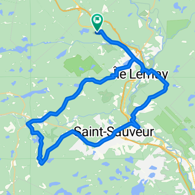
 ste adele bellefeuille ste adele
- Distance
- 66.6 km
- Ascent
- 908 m
- Descent
- 905 m
- Location
- Sainte-Adèle, Quebec, Canada
 Legendary Spill
- Distance
- 52.3 km
- Ascent
- 500 m
- Descent
- 506 m
- Location
- Sainte-Adèle, Quebec, Canada
 GARENUT120ISH2018
- Distance
- 127 km
- Ascent
- 717 m
- Descent
- 717 m
- Location
- Sainte-Adèle, Quebec, Canada
 ste adele
- Distance
- 46.1 km
- Ascent
- 626 m
- Descent
- 674 m
- Location
- Sainte-Adèle, Quebec, Canada
Open it in the app