

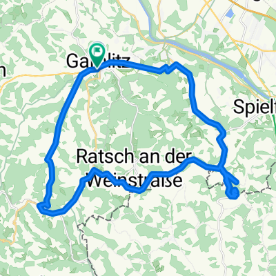
Gamlitz 2018
A cycling route starting in Gamlitz, Styria, Austria.
Overview
About this route
- 2 h
- Duration
- 13 km
- Distance
- 407 m
- Ascent
- 232 m
- Descent
- 6.5 km/h
- Avg. speed
- ---
- Max. altitude

Route photos


Route quality
Waytypes & surfaces along the route
Waytypes
Road
5.9 km
(45 %)
Cycleway
1.4 km
(11 %)
Surfaces
Paved
1.2 km
(9 %)
Unpaved
0.1 km
(1 %)
Asphalt
1.2 km
(9 %)
Ground
0.1 km
(1 %)
Undefined
11.7 km
(90 %)
Continue with Bikemap
Use, edit, or download this cycling route
You would like to ride Gamlitz 2018 or customize it for your own trip? Here is what you can do with this Bikemap route:
Free features
- Save this route as favorite or in collections
- Copy & plan your own version of this route
- Sync your route with Garmin or Wahoo
Premium features
Free trial for 3 days, or one-time payment. More about Bikemap Premium.
- Navigate this route on iOS & Android
- Export a GPX / KML file of this route
- Create your custom printout (try it for free)
- Download this route for offline navigation
Discover more Premium features.
Get Bikemap PremiumFrom our community
Other popular routes starting in Gamlitz
 20190914 GAM1
- Distance
- 48.3 km
- Ascent
- 966 m
- Descent
- 976 m
- Location
- Gamlitz, Styria, Austria
 Josef-Zierer-Weg nach Josef-Zierer-Weg
- Distance
- 28 km
- Ascent
- 541 m
- Descent
- 593 m
- Location
- Gamlitz, Styria, Austria
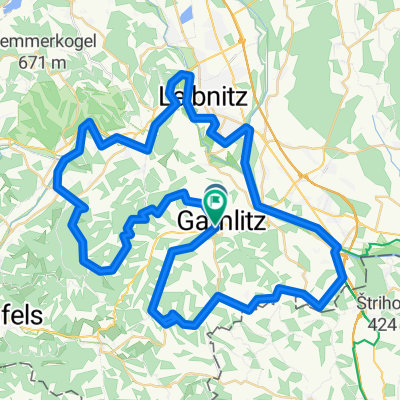 Weinstraßentour
- Distance
- 77.5 km
- Ascent
- 1,631 m
- Descent
- 1,631 m
- Location
- Gamlitz, Styria, Austria
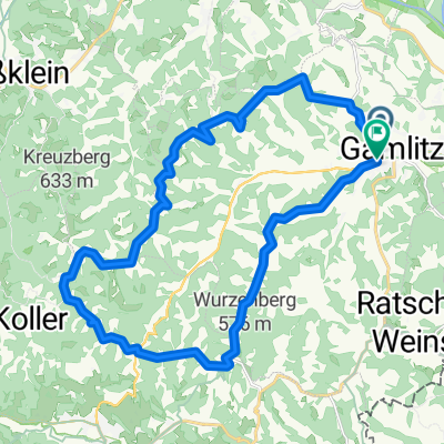
 Gamlitz-Mureck-Gamlitz
- Distance
- 48.3 km
- Ascent
- 87 m
- Descent
- 90 m
- Location
- Gamlitz, Styria, Austria
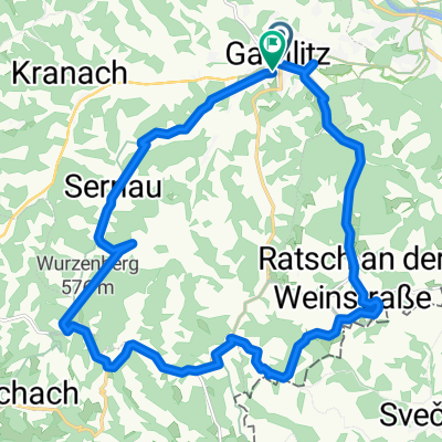
 ehrenhausen
- Distance
- 25.6 km
- Ascent
- 764 m
- Descent
- 763 m
- Location
- Gamlitz, Styria, Austria
 Gamlitz 2018
- Distance
- 13 km
- Ascent
- 407 m
- Descent
- 232 m
- Location
- Gamlitz, Styria, Austria
 Südsteirische Tour
- Distance
- 70.7 km
- Ascent
- 1,003 m
- Descent
- 938 m
- Location
- Gamlitz, Styria, Austria
 Josef-Zierer-Weg 222a nach Josef-Zierer-Weg
- Distance
- 22.4 km
- Ascent
- 521 m
- Descent
- 573 m
- Location
- Gamlitz, Styria, Austria
Open it in the app