

Goldrain - Ruine Schloss Montani - Trimdichpfad Latsch - Radweg / St. Martin Seilbahn ;)
A cycling route starting in Latsch, Trentino-Alto Adige, Italy.
Overview
About this route
- 2 h 19 min
- Duration
- 11.9 km
- Distance
- 1,885 m
- Ascent
- 1,953 m
- Descent
- 5.2 km/h
- Avg. speed
- ---
- Max. altitude

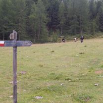
Route photos
\"")
\"")
\"")
\"")
\"")
Continue with Bikemap
Use, edit, or download this cycling route
You would like to ride Goldrain - Ruine Schloss Montani - Trimdichpfad Latsch - Radweg / St. Martin Seilbahn ;) or customize it for your own trip? Here is what you can do with this Bikemap route:
Free features
- Save this route as favorite or in collections
- Copy & plan your own version of this route
- Sync your route with Garmin or Wahoo
Premium features
Free trial for 3 days, or one-time payment. More about Bikemap Premium.
- Navigate this route on iOS & Android
- Export a GPX / KML file of this route
- Create your custom printout (try it for free)
- Download this route for offline navigation
Discover more Premium features.
Get Bikemap PremiumFrom our community
Other popular routes starting in Latsch
 LatscherAlm-TarscherAlm-MarzonerAlm Tour S2
- Distance
- 48.7 km
- Ascent
- 2,023 m
- Descent
- 2,024 m
- Location
- Latsch, Trentino-Alto Adige, Italy
 Martelltal bis zum Stausee
- Distance
- 48.9 km
- Ascent
- 1,551 m
- Descent
- 1,542 m
- Location
- Latsch, Trentino-Alto Adige, Italy
 Transalp Schmuggler 4
- Distance
- 35.1 km
- Ascent
- 1,936 m
- Descent
- 1,324 m
- Location
- Latsch, Trentino-Alto Adige, Italy
 Latsch Trail 13 Runde S2
- Distance
- 16.9 km
- Ascent
- 734 m
- Descent
- 730 m
- Location
- Latsch, Trentino-Alto Adige, Italy
 Latscher - Tarscher - Alm
- Distance
- 27.3 km
- Ascent
- 1,393 m
- Descent
- 1,388 m
- Location
- Latsch, Trentino-Alto Adige, Italy
 Uphill Schloss-Annenberg
- Distance
- 13.8 km
- Ascent
- 1,125 m
- Descent
- 34 m
- Location
- Latsch, Trentino-Alto Adige, Italy
 Latscher Trail Zauber S2 (gross)
- Distance
- 15.8 km
- Ascent
- 552 m
- Descent
- 553 m
- Location
- Latsch, Trentino-Alto Adige, Italy
 Vinschgau 05 (Haslhof)
- Distance
- 28.6 km
- Ascent
- 1,284 m
- Descent
- 1,284 m
- Location
- Latsch, Trentino-Alto Adige, Italy
Open it in the app