Etapa 018C (Nantes - Gennes)
A cycling route starting in Thouaré-sur-Loire, Pays de la Loire Region, France.
Overview
About this route
Western Europe Tour. Stage 18
Nantes - Mauves sur Loire - La Varenne - Oudon - Ancenis - Saint Florent le Vieil - Montjean sur Loire - La Possonnière - Savennières - La Pointe - Bouchemaine - Angers - Saint Mathurin sur Loire - Gennes
139.6 km
500 m total positive elevation gain
- -:--
- Duration
- 139.6 km
- Distance
- 498 m
- Ascent
- 475 m
- Descent
- ---
- Avg. speed
- 56 m
- Max. altitude
Route quality
Waytypes & surfaces along the route
Waytypes
Quiet road
55.8 km
(40 %)
Road
30.7 km
(22 %)
Surfaces
Paved
92.1 km
(66 %)
Unpaved
26.5 km
(19 %)
Asphalt
89.3 km
(64 %)
Gravel
20.9 km
(15 %)
Route highlights
Points of interest along the route
Point of interest after 21.9 km
Castillo Medieval de Oudon
Point of interest after 32.4 km
Castillo de Ancenis
Point of interest after 99.8 km
La Maison d'Adam
Point of interest after 100.1 km
Plaza de Raillament
Point of interest after 100.5 km
Catedral de San Mauricio
Point of interest after 101 km
Castillo
Accommodation after 139.6 km
Au Bord de Loire
Continue with Bikemap
Use, edit, or download this cycling route
You would like to ride Etapa 018C (Nantes - Gennes) or customize it for your own trip? Here is what you can do with this Bikemap route:
Free features
- Save this route as favorite or in collections
- Copy & plan your own version of this route
- Split it into stages to create a multi-day tour
- Sync your route with Garmin or Wahoo
Premium features
Free trial for 3 days, or one-time payment. More about Bikemap Premium.
- Navigate this route on iOS & Android
- Export a GPX / KML file of this route
- Create your custom printout (try it for free)
- Download this route for offline navigation
Discover more Premium features.
Get Bikemap PremiumFrom our community
Other popular routes starting in Thouaré-sur-Loire
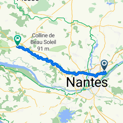
Thouaré-sur-Loire à 51 Le Clairvoyant, Mauges-sur-Loire- Distance
- 54.3 km
- Ascent
- 118 m
- Descent
- 110 m
- Location
- Thouaré-sur-Loire, Pays de la Loire Region, France
De Thouaré à Place de la Gare- Distance
- 86.4 km
- Ascent
- 1,099 m
- Descent
- 1,100 m
- Location
- Thouaré-sur-Loire, Pays de la Loire Region, France
13 Impasse Ferdinand Magellan, Thouaré-sur-Loire à 49 Rue de la Bourgeonnière, Nantes- Distance
- 11.2 km
- Ascent
- 62 m
- Descent
- 57 m
- Location
- Thouaré-sur-Loire, Pays de la Loire Region, France
Snail-like route in Nantes- Distance
- 14.3 km
- Ascent
- 668 m
- Descent
- 658 m
- Location
- Thouaré-sur-Loire, Pays de la Loire Region, France
Etapa 018C (Nantes - Gennes)- Distance
- 139.6 km
- Ascent
- 498 m
- Descent
- 475 m
- Location
- Thouaré-sur-Loire, Pays de la Loire Region, France
EV6_Jour 02_26 juillet 2010- Distance
- 118.7 km
- Ascent
- 109 m
- Descent
- 97 m
- Location
- Thouaré-sur-Loire, Pays de la Loire Region, France
5 giugno- Distance
- 87.7 km
- Ascent
- 342 m
- Descent
- 330 m
- Location
- Thouaré-sur-Loire, Pays de la Loire Region, France
Tag10 Tour 2020 Sainte Luce sur Loire nach Nantes Bahnhof- Distance
- 9.9 km
- Ascent
- 11 m
- Descent
- 8 m
- Location
- Thouaré-sur-Loire, Pays de la Loire Region, France
Open it in the app


