

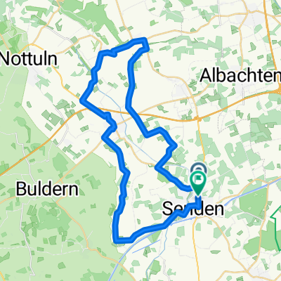
MS-Land_51km_Venner Moor
A cycling route starting in Senden, North Rhine-Westphalia, Germany.
Overview
About this route
Vom Hotel Venner Moor über Ascheberg und Lüdinghausen zurück 51 km
- -:--
- Duration
- 51.1 km
- Distance
- 61 m
- Ascent
- 65 m
- Descent
- ---
- Avg. speed
- ---
- Max. altitude
Route quality
Waytypes & surfaces along the route
Waytypes
Quiet road
31.2 km
(61 %)
Road
6.1 km
(12 %)
Surfaces
Paved
45 km
(88 %)
Unpaved
2 km
(4 %)
Asphalt
45 km
(88 %)
Gravel
1.5 km
(3 %)
Continue with Bikemap
Use, edit, or download this cycling route
You would like to ride MS-Land_51km_Venner Moor or customize it for your own trip? Here is what you can do with this Bikemap route:
Free features
- Save this route as favorite or in collections
- Copy & plan your own version of this route
- Sync your route with Garmin or Wahoo
Premium features
Free trial for 3 days, or one-time payment. More about Bikemap Premium.
- Navigate this route on iOS & Android
- Export a GPX / KML file of this route
- Create your custom printout (try it for free)
- Download this route for offline navigation
Discover more Premium features.
Get Bikemap PremiumFrom our community
Other popular routes starting in Senden
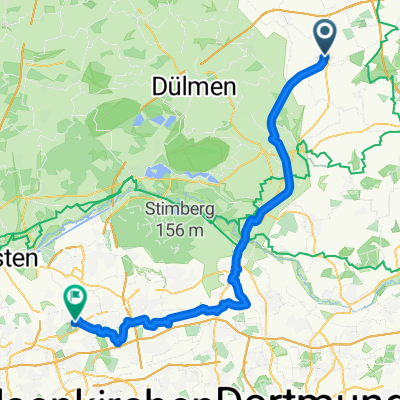 01.01 - Senden 》Herten
- Distance
- 61.4 km
- Ascent
- 205 m
- Descent
- 189 m
- Location
- Senden, North Rhine-Westphalia, Germany
 CE110916
- Distance
- 22.8 km
- Ascent
- 39 m
- Descent
- 37 m
- Location
- Senden, North Rhine-Westphalia, Germany
 Route zu Schloss Wilkinghege II 60
- Distance
- 60 km
- Ascent
- 139 m
- Descent
- 125 m
- Location
- Senden, North Rhine-Westphalia, Germany
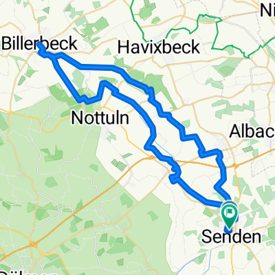
 Route in Senden
- Distance
- 37.8 km
- Ascent
- 129 m
- Descent
- 128 m
- Location
- Senden, North Rhine-Westphalia, Germany
 MS-Land_51km_Venner Moor
- Distance
- 51.1 km
- Ascent
- 61 m
- Descent
- 65 m
- Location
- Senden, North Rhine-Westphalia, Germany
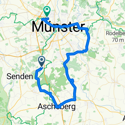
 Münster 2019
- Distance
- 44.8 km
- Ascent
- 52 m
- Descent
- 51 m
- Location
- Senden, North Rhine-Westphalia, Germany
 2 Longinusturm
- Distance
- 36.1 km
- Ascent
- 186 m
- Descent
- 187 m
- Location
- Senden, North Rhine-Westphalia, Germany
 Finkenweg nach Finkenweg
- Distance
- 52.8 km
- Ascent
- 265 m
- Descent
- 265 m
- Location
- Senden, North Rhine-Westphalia, Germany
Open it in the app