

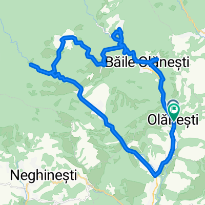
MCO - Cantonul Cheia
A cycling route starting in Olănești, Vâlcea County, Romania.
Overview
About this route
One can drive almost to the Iezer Monastery. On the way to the Cheia canton, there is also the Pahomie Monastery on the left side. This route can also be taken in the rain. ***An entrance fee is charged for the Buila Vanturarita National Park.
- -:--
- Duration
- 27.6 km
- Distance
- 770 m
- Ascent
- 225 m
- Descent
- ---
- Avg. speed
- ---
- Max. altitude

Continue with Bikemap
Use, edit, or download this cycling route
You would like to ride MCO - Cantonul Cheia or customize it for your own trip? Here is what you can do with this Bikemap route:
Free features
- Save this route as favorite or in collections
- Copy & plan your own version of this route
- Sync your route with Garmin or Wahoo
Premium features
Free trial for 3 days, or one-time payment. More about Bikemap Premium.
- Navigate this route on iOS & Android
- Export a GPX / KML file of this route
- Create your custom printout (try it for free)
- Download this route for offline navigation
Discover more Premium features.
Get Bikemap PremiumFrom our community
Other popular routes starting in Olănești
 Olănești
- Distance
- 41.6 km
- Ascent
- 782 m
- Descent
- 782 m
- Location
- Olănești, Vâlcea County, Romania
 Buila 2
- Distance
- 43.7 km
- Ascent
- 885 m
- Descent
- 889 m
- Location
- Olănești, Vâlcea County, Romania
 Buila
Buila- Distance
- 43.9 km
- Ascent
- 871 m
- Descent
- 874 m
- Location
- Olănești, Vâlcea County, Romania
 Traseu 1 Olanesti - Pietrișu - Gurguiata
- Distance
- 28.7 km
- Ascent
- 549 m
- Descent
- 550 m
- Location
- Olănești, Vâlcea County, Romania
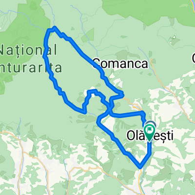
 Traseu Buila Vanturarita - Pahomie, Cheia
- Distance
- 56.7 km
- Ascent
- 1,201 m
- Descent
- 1,201 m
- Location
- Olănești, Vâlcea County, Romania
 Olanesti-Schitul Pahomie-Cabana Cheia-Cheile Folea-Olanesti
- Distance
- 63.7 km
- Ascent
- 6,206 m
- Descent
- 6,173 m
- Location
- Olănești, Vâlcea County, Romania
 Traseu 3 avansat - Olanesti
- Distance
- 43.1 km
- Ascent
- 939 m
- Descent
- 946 m
- Location
- Olănești, Vâlcea County, Romania
 Traseu Valea Cheii - Cabana Cheia
- Distance
- 55.6 km
- Ascent
- 1,147 m
- Descent
- 1,145 m
- Location
- Olănești, Vâlcea County, Romania
Open it in the app