

Etapa 046C (Dresden - Děčín)
A cycling route starting in Bannewitz, Saxony, Germany.
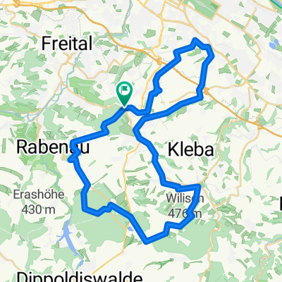
Overview
About this route
Vuelta a Europa occidental. Etapa 46
Dresden - Heidenau - Pirna - Stadt Wehlen - Rathen - Königstein - Bad Schandau - REPÚBLICA CHECA - Děčín
91.8 km
870 m desnivel positivo acumulado
- 6 h 1 min
- Duration
- 91.8 km
- Distance
- 869 m
- Ascent
- 860 m
- Descent
- 15.3 km/h
- Avg. speed
- 357 m
- Max. altitude

Route quality
Waytypes & surfaces along the route
Waytypes
Quiet road
30.5 km
(33 %)
Cycleway
30.4 km
(33 %)
Surfaces
Paved
83.1 km
(91 %)
Unpaved
1.5 km
(2 %)
Asphalt
78.3 km
(85 %)
Paving stones
4 km
(4 %)
Route highlights
Points of interest along the route
Point of interest after 6.7 km
Dresdner Zwinger
Point of interest after 6.8 km
Altmarkt
Point of interest after 6.8 km
Residenzschloss
Point of interest after 6.9 km
Semperoper Dresden
Point of interest after 7.1 km
Katholische Hofkirche
Point of interest after 7.2 km
Schlossplatz
Point of interest after 7.2 km
Fürstenzug
Point of interest after 7.2 km
Frauenkirche
Point of interest after 7.4 km
Brühlsche Terrasse
Point of interest after 7.6 km
Goldener Reiter
Point of interest after 9.4 km
Kunsthofpassage Dresden
Point of interest after 13 km
Gläserne Manufaktur
Point of interest after 14.7 km
Palais Großer Garten
Point of interest after 33.5 km
Historischer Marktplatz
Point of interest after 33.7 km
Stadtkirche St. Marien
Point of interest after 53.1 km
Festung Königstein
Point of interest after 84.5 km
Zámek Děčín
Point of interest after 85.3 km
Staroměstský most
Continue with Bikemap
Use, edit, or download this cycling route
You would like to ride Etapa 046C (Dresden - Děčín) or customize it for your own trip? Here is what you can do with this Bikemap route:
Free features
- Save this route as favorite or in collections
- Copy & plan your own version of this route
- Split it into stages to create a multi-day tour
- Sync your route with Garmin or Wahoo
Premium features
Free trial for 3 days, or one-time payment. More about Bikemap Premium.
- Navigate this route on iOS & Android
- Export a GPX / KML file of this route
- Create your custom printout (try it for free)
- Download this route for offline navigation
Discover more Premium features.
Get Bikemap PremiumFrom our community
Other popular routes starting in Bannewitz
 kleine Sonntagsrunde
- Distance
- 23 km
- Ascent
- 337 m
- Descent
- 245 m
- Location
- Bannewitz, Saxony, Germany
 Windberg-Poisenwald-Tharandt
- Distance
- 47.2 km
- Ascent
- 865 m
- Descent
- 865 m
- Location
- Bannewitz, Saxony, Germany
 Die Autobahntour: 34 km Hügel im Dresdner Süden
- Distance
- 33.9 km
- Ascent
- 549 m
- Descent
- 548 m
- Location
- Bannewitz, Saxony, Germany
 Südhöhe-Kaitzbachquelle und zurück
- Distance
- 9.9 km
- Ascent
- 170 m
- Descent
- 190 m
- Location
- Bannewitz, Saxony, Germany
 MTB Tour Windberg, Heidemühle, Wilisch, Windberg CLONED FROM ROUTE 182971
- Distance
- 42.5 km
- Ascent
- 628 m
- Descent
- 662 m
- Location
- Bannewitz, Saxony, Germany
 👌🏽😎AROUNDTRAILFREITAL😎👌🏽
- Distance
- 60.9 km
- Ascent
- 1,308 m
- Descent
- 1,302 m
- Location
- Bannewitz, Saxony, Germany
 Radtour Elberadweg
- Distance
- 30.6 km
- Ascent
- 26 m
- Descent
- 32 m
- Location
- Bannewitz, Saxony, Germany
 Südhöhe - Rundfahrt
- Distance
- 53.5 km
- Ascent
- 792 m
- Descent
- 747 m
- Location
- Bannewitz, Saxony, Germany
Open it in the app