
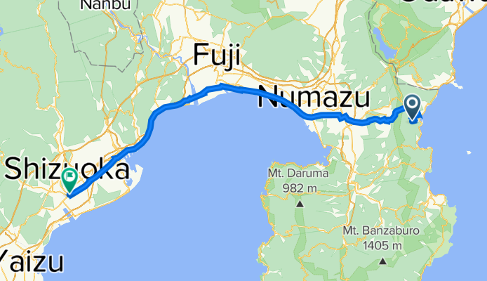
atami shizuoka
A cycling route starting in Atami, Shizuoka, Japan.
Overview
About this route
- -:--
- Duration
- 82.6 km
- Distance
- 432 m
- Ascent
- 630 m
- Descent
- ---
- Avg. speed
- ---
- Max. altitude

Route quality
Waytypes & surfaces along the route
Waytypes
Quiet road
43.8 km
(53 %)
Road
19.8 km
(24 %)
Surfaces
Paved
1.7 km
(2 %)
Paved (undefined)
0.8 km
(1 %)
Asphalt
0.8 km
(1 %)
Undefined
81 km
(98 %)
Continue with Bikemap
Use, edit, or download this cycling route
You would like to ride atami shizuoka or customize it for your own trip? Here is what you can do with this Bikemap route:
Free features
- Save this route as favorite or in collections
- Copy & plan your own version of this route
- Split it into stages to create a multi-day tour
- Sync your route with Garmin or Wahoo
Premium features
Free trial for 3 days, or one-time payment. More about Bikemap Premium.
- Navigate this route on iOS & Android
- Export a GPX / KML file of this route
- Create your custom printout (try it for free)
- Download this route for offline navigation
Discover more Premium features.
Get Bikemap PremiumFrom our community
Other popular routes starting in Atami
 Atami nach Yokohama
- Distance
- 80.9 km
- Ascent
- 960 m
- Descent
- 1,067 m
- Location
- Atami, Shizuoka, Japan
 Taga-Manaz
- Distance
- 54.4 km
- Ascent
- 1,574 m
- Descent
- 1,472 m
- Location
- Atami, Shizuoka, Japan
 atami shizuoka
- Distance
- 82.6 km
- Ascent
- 432 m
- Descent
- 630 m
- Location
- Atami, Shizuoka, Japan
 ToJ18 - Atami Circuit (Hilly)
- Distance
- 71.9 km
- Ascent
- 1,595 m
- Descent
- 1,573 m
- Location
- Atami, Shizuoka, Japan
 tomorrow
- Distance
- 83 km
- Ascent
- 2,524 m
- Descent
- 2,597 m
- Location
- Atami, Shizuoka, Japan
 9/24 Atami to Yokohama
- Distance
- 91.2 km
- Ascent
- 702 m
- Descent
- 764 m
- Location
- Atami, Shizuoka, Japan
 osaka from atami
- Distance
- 418.2 km
- Ascent
- 3,040 m
- Descent
- 3,114 m
- Location
- Atami, Shizuoka, Japan
 tokyo - kyoto part3
- Distance
- 166.4 km
- Ascent
- 811 m
- Descent
- 868 m
- Location
- Atami, Shizuoka, Japan
Open it in the app