

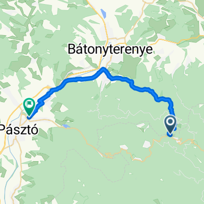
Galyatető
A cycling route starting in Paradsasvar, Heves County, Hungary.
Overview
About this route
- 3 h 6 min
- Duration
- 30.5 km
- Distance
- 1,252 m
- Ascent
- 1,209 m
- Descent
- 9.8 km/h
- Avg. speed
- ---
- Max. altitude

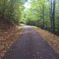
Route photos

Continue with Bikemap
Use, edit, or download this cycling route
You would like to ride Galyatető or customize it for your own trip? Here is what you can do with this Bikemap route:
Free features
- Save this route as favorite or in collections
- Copy & plan your own version of this route
- Sync your route with Garmin or Wahoo
Premium features
Free trial for 3 days, or one-time payment. More about Bikemap Premium.
- Navigate this route on iOS & Android
- Export a GPX / KML file of this route
- Create your custom printout (try it for free)
- Download this route for offline navigation
Discover more Premium features.
Get Bikemap PremiumFrom our community
Other popular routes starting in Paradsasvar
 Sasvár Challenge
- Distance
- 34.4 km
- Ascent
- 840 m
- Descent
- 847 m
- Location
- Paradsasvar, Heves County, Hungary
 Mátrai Tavasz :)
- Distance
- 77.7 km
- Ascent
- 1,578 m
- Descent
- 1,575 m
- Location
- Paradsasvar, Heves County, Hungary
 Route zu Pásztó Retro Csárda
- Distance
- 24.6 km
- Ascent
- 221 m
- Descent
- 934 m
- Location
- Paradsasvar, Heves County, Hungary
 Névtelen Út - Béke utca
- Distance
- 15 km
- Ascent
- 191 m
- Descent
- 598 m
- Location
- Paradsasvar, Heves County, Hungary
 Túramátra
- Distance
- 9.3 km
- Ascent
- 466 m
- Descent
- 470 m
- Location
- Paradsasvar, Heves County, Hungary
 Mátra Cycling
- Distance
- 59.6 km
- Ascent
- 1,315 m
- Descent
- 1,311 m
- Location
- Paradsasvar, Heves County, Hungary
 Galyatető
- Distance
- 30.5 km
- Ascent
- 1,252 m
- Descent
- 1,209 m
- Location
- Paradsasvar, Heves County, Hungary
 Parádsasvár - Kékestető
- Distance
- 26.7 km
- Ascent
- 772 m
- Descent
- 770 m
- Location
- Paradsasvar, Heves County, Hungary
Open it in the app