

GRIMSELPASS (por Oberwald)
A cycling route starting in Airolo, Canton Ticino, Switzerland.
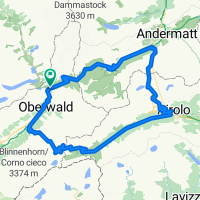
Overview
About this route
- -:--
- Duration
- 17.9 km
- Distance
- 1,026 m
- Ascent
- 83 m
- Descent
- ---
- Avg. speed
- ---
- Max. altitude

Route quality
Waytypes & surfaces along the route
Waytypes
Quiet road
5.7 km
(32 %)
Undefined
12.2 km
(68 %)
Surfaces
Paved
17.9 km
(100 %)
Asphalt
17.9 km
(100 %)
Continue with Bikemap
Use, edit, or download this cycling route
You would like to ride GRIMSELPASS (por Oberwald) or customize it for your own trip? Here is what you can do with this Bikemap route:
Free features
- Save this route as favorite or in collections
- Copy & plan your own version of this route
- Sync your route with Garmin or Wahoo
Premium features
Free trial for 3 days, or one-time payment. More about Bikemap Premium.
- Navigate this route on iOS & Android
- Export a GPX / KML file of this route
- Create your custom printout (try it for free)
- Download this route for offline navigation
Discover more Premium features.
Get Bikemap PremiumFrom our community
Other popular routes starting in Airolo
 Nufenen, Gotthard, Furka
- Distance
- 96.1 km
- Ascent
- 2,984 m
- Descent
- 2,984 m
- Location
- Airolo, Canton Ticino, Switzerland
 Upper Leventina
- Distance
- 49.8 km
- Ascent
- 746 m
- Descent
- 1,596 m
- Location
- Airolo, Canton Ticino, Switzerland
 025 - 2014
- Distance
- 75 km
- Ascent
- 1,496 m
- Descent
- 2,088 m
- Location
- Airolo, Canton Ticino, Switzerland
 Passo della Novena
- Distance
- 35.4 km
- Ascent
- 1,259 m
- Descent
- 1,262 m
- Location
- Airolo, Canton Ticino, Switzerland
 1_Airolo - Biasca
- Distance
- 116.2 km
- Ascent
- 3,060 m
- Descent
- 3,901 m
- Location
- Airolo, Canton Ticino, Switzerland
 nufenen . furka . gottardo
- Distance
- 100.3 km
- Ascent
- 2,941 m
- Descent
- 2,941 m
- Location
- Airolo, Canton Ticino, Switzerland
 Lago Ritom - Andermatt
- Distance
- 65.9 km
- Ascent
- 1,393 m
- Descent
- 1,774 m
- Location
- Airolo, Canton Ticino, Switzerland
 Massiv Alp 10
- Distance
- 280.9 km
- Ascent
- 14,277 m
- Descent
- 13,392 m
- Location
- Airolo, Canton Ticino, Switzerland
Open it in the app