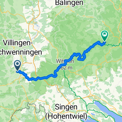
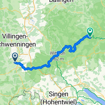
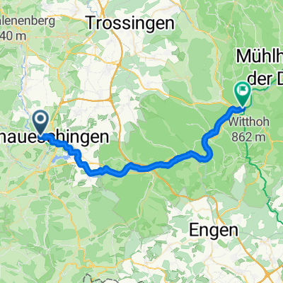
Donauradweg DE 1
A cycling route starting in Donaueschingen, Baden-Wurttemberg, Germany.
Overview
About this route
Donaueschingen
Pfohren
Geisingen
Hintschingen
Immendingen
Mauenheim
Bargen
Engen
Aach
Aachquelle
Aach
Engen
- -:--
- Duration
- 55.7 km
- Distance
- 277 m
- Ascent
- 482 m
- Descent
- ---
- Avg. speed
- ---
- Max. altitude
Route quality
Waytypes & surfaces along the route
Waytypes
Track
15.7 km
(28 %)
Cycleway
9.6 km
(17 %)
Surfaces
Paved
49.7 km
(89 %)
Unpaved
4.1 km
(7 %)
Asphalt
46.1 km
(83 %)
Paved (undefined)
2.9 km
(5 %)
Continue with Bikemap
Use, edit, or download this cycling route
You would like to ride Donauradweg DE 1 or customize it for your own trip? Here is what you can do with this Bikemap route:
Free features
- Save this route as favorite or in collections
- Copy & plan your own version of this route
- Sync your route with Garmin or Wahoo
Premium features
Free trial for 3 days, or one-time payment. More about Bikemap Premium.
- Navigate this route on iOS & Android
- Export a GPX / KML file of this route
- Create your custom printout (try it for free)
- Download this route for offline navigation
Discover more Premium features.
Get Bikemap PremiumFrom our community
Other popular routes starting in Donaueschingen
- Donauradweg
- Distance
- 984.1 km
- Ascent
- 267 m
- Descent
- 552 m
- Location
- Donaueschingen, Baden-Wurttemberg, Germany
- Donauradweg (1)
- Distance
- 295 km
- Ascent
- 163 m
- Descent
- 434 m
- Location
- Donaueschingen, Baden-Wurttemberg, Germany
- From Donaueschingen to Fridingen an der Donau
- Distance
- 61.9 km
- Ascent
- 439 m
- Descent
- 504 m
- Location
- Donaueschingen, Baden-Wurttemberg, Germany
- Donautour 1.Etappe
- Distance
- 99.3 km
- Ascent
- 311 m
- Descent
- 407 m
- Location
- Donaueschingen, Baden-Wurttemberg, Germany
- Le Danube - 1ere partie
- Distance
- 932.4 km
- Ascent
- 318 m
- Descent
- 768 m
- Location
- Donaueschingen, Baden-Wurttemberg, Germany
- 31km-DonauEntspring Donaueschingen
- Distance
- 31.3 km
- Ascent
- 180 m
- Descent
- 181 m
- Location
- Donaueschingen, Baden-Wurttemberg, Germany
- Donaueschingen - Fürstenberg - Geisingen - Donaueschingen
- Distance
- 50.2 km
- Ascent
- 249 m
- Descent
- 249 m
- Location
- Donaueschingen, Baden-Wurttemberg, Germany
- Der Donauradweg
- Distance
- 622.8 km
- Ascent
- 3,031 m
- Descent
- 3,406 m
- Location
- Donaueschingen, Baden-Wurttemberg, Germany
Open it in the app