

OKT Gömöri Kék 2
A cycling route starting in Rudabánya, Borsod-Abauj Zemplen county, Hungary.
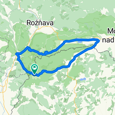
Overview
About this route
National Blue Trail
Jósvafő
Jósvafő Cave
Aggtelek
Zádorfalva
- -:--
- Duration
- 22.4 km
- Distance
- 512 m
- Ascent
- 506 m
- Descent
- ---
- Avg. speed
- ---
- Max. altitude

Route quality
Waytypes & surfaces along the route
Waytypes
Path
9.4 km
(42 %)
Track
8.7 km
(39 %)
Surfaces
Paved
2.9 km
(13 %)
Unpaved
15.3 km
(68 %)
Ground
14.8 km
(66 %)
Asphalt
2.7 km
(12 %)
Continue with Bikemap
Use, edit, or download this cycling route
You would like to ride OKT Gömöri Kék 2 or customize it for your own trip? Here is what you can do with this Bikemap route:
Free features
- Save this route as favorite or in collections
- Copy & plan your own version of this route
- Sync your route with Garmin or Wahoo
Premium features
Free trial for 3 days, or one-time payment. More about Bikemap Premium.
- Navigate this route on iOS & Android
- Export a GPX / KML file of this route
- Create your custom printout (try it for free)
- Download this route for offline navigation
Discover more Premium features.
Get Bikemap PremiumFrom our community
Other popular routes starting in Rudabánya
 SZLOVÁKIA 1
- Distance
- 93.2 km
- Ascent
- 636 m
- Descent
- 632 m
- Location
- Rudabánya, Borsod-Abauj Zemplen county, Hungary
 2. kerékpáros túra - 3. etap
- Distance
- 78.5 km
- Ascent
- 195 m
- Descent
- 406 m
- Location
- Rudabánya, Borsod-Abauj Zemplen county, Hungary
 Északi Zöld 10
- Distance
- 27.8 km
- Ascent
- 203 m
- Descent
- 381 m
- Location
- Rudabánya, Borsod-Abauj Zemplen county, Hungary
 Aggtelek 5.
- Distance
- 23.7 km
- Ascent
- 139 m
- Descent
- 262 m
- Location
- Rudabánya, Borsod-Abauj Zemplen county, Hungary
 Jósvafő-Sk
- Distance
- 99.7 km
- Ascent
- 727 m
- Descent
- 728 m
- Location
- Rudabánya, Borsod-Abauj Zemplen county, Hungary
 OKT Gömöri Kék 2
- Distance
- 22.4 km
- Ascent
- 512 m
- Descent
- 506 m
- Location
- Rudabánya, Borsod-Abauj Zemplen county, Hungary
 Aggtelek-Szlovák Karszt körtúra I.
- Distance
- 94.3 km
- Ascent
- 647 m
- Descent
- 649 m
- Location
- Rudabánya, Borsod-Abauj Zemplen county, Hungary
 Poprad - Eger 4. deň
- Distance
- 98.4 km
- Ascent
- 969 m
- Descent
- 1,040 m
- Location
- Rudabánya, Borsod-Abauj Zemplen county, Hungary
Open it in the app