

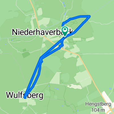
Heide-und Hermann Löns Wanderweg
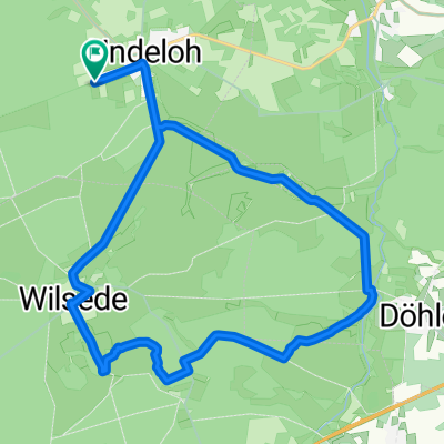
A cycling route starting in Undeloh, Lower Saxony, Germany.
Overview
About this route
Der Hermann - Löns Wanderweg ist nichts für Tourenräder. Entweder mit viel Strom oder mit viel Übersetzung.
- -:--
- Duration
- 51.5 km
- Distance
- 263 m
- Ascent
- 263 m
- Descent
- ---
- Avg. speed
- ---
- Max. altitude

Route quality
Waytypes & surfaces along the route
Waytypes
Track
22.5 km
(44 %)
Path
13.9 km
(27 %)
Surfaces
Paved
14.1 km
(27 %)
Unpaved
31.4 km
(61 %)
Asphalt
10.7 km
(21 %)
Sand
8.6 km
(17 %)
Continue with Bikemap
Use, edit, or download this cycling route
You would like to ride Heide-und Hermann Löns Wanderweg or customize it for your own trip? Here is what you can do with this Bikemap route:
Free features
- Save this route as favorite or in collections
- Copy & plan your own version of this route
- Sync your route with Garmin or Wahoo
Premium features
Free trial for 3 days, or one-time payment. More about Bikemap Premium.
- Navigate this route on iOS & Android
- Export a GPX / KML file of this route
- Create your custom printout (try it for free)
- Download this route for offline navigation
Discover more Premium features.
Get Bikemap PremiumFrom our community
Other popular routes starting in Undeloh
 Wilseder Berg nach Lüneburg - Nordroute 36 km
- Distance
- 36.3 km
- Ascent
- 130 m
- Descent
- 269 m
- Location
- Undeloh, Lower Saxony, Germany
 Radtour Lüneburger Heide
- Distance
- 44.1 km
- Ascent
- 242 m
- Descent
- 241 m
- Location
- Undeloh, Lower Saxony, Germany
 Wilseder Berg
- Distance
- 16.6 km
- Ascent
- 93 m
- Descent
- 85 m
- Location
- Undeloh, Lower Saxony, Germany
 Die Schöne Heide
- Distance
- 17.2 km
- Ascent
- 249 m
- Descent
- 232 m
- Location
- Undeloh, Lower Saxony, Germany
 Durch d. Naturpark Lüneburger Heide
- Distance
- 46.2 km
- Ascent
- 371 m
- Descent
- 374 m
- Location
- Undeloh, Lower Saxony, Germany
 Wilseder Berg
- Distance
- 9.2 km
- Ascent
- 110 m
- Descent
- 112 m
- Location
- Undeloh, Lower Saxony, Germany
 Aussichtspunkt Totengrund – Heide Runde von Undeloh
- Distance
- 18.3 km
- Ascent
- 148 m
- Descent
- 148 m
- Location
- Undeloh, Lower Saxony, Germany
 Durch d. Naturpark Lüneburger Heide
- Distance
- 46.2 km
- Ascent
- 397 m
- Descent
- 398 m
- Location
- Undeloh, Lower Saxony, Germany
Open it in the app