
Overview
About this route
- -:--
- Duration
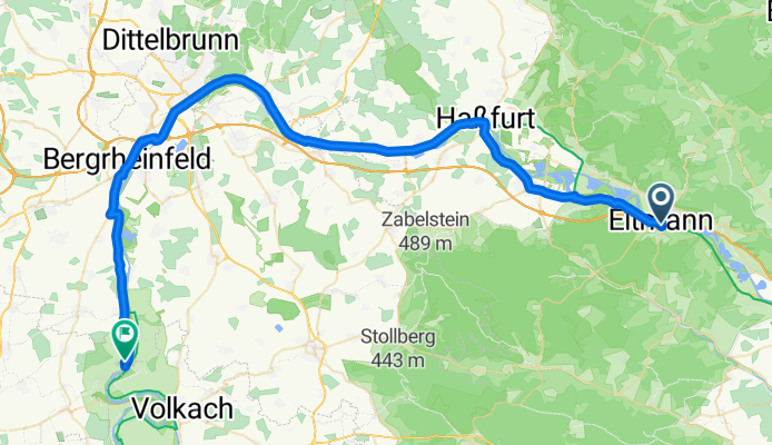
- 59.9 km
- Distance
- 94 m
- Ascent
- 119 m
- Descent
- ---
- Avg. speed
- ---
- Max. altitude

Part of
2018 Main
11 stages
Route quality
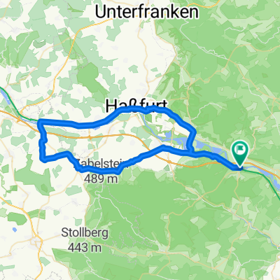
Waytypes & surfaces along the route
Waytypes
Path
39 km
(65 %)
Quiet road
6.6 km
(11 %)
Surfaces
Paved
57.5 km
(96 %)
Asphalt
55.1 km
(92 %)
Concrete
2.4 km
(4 %)
Undefined
2.4 km
(4 %)
Continue with Bikemap
Use, edit, or download this cycling route
You would like to ride 28.08.18_Eltmann nach Obereisenheim or customize it for your own trip? Here is what you can do with this Bikemap route:
Free features
- Save this route as favorite or in collections
- Copy & plan your own version of this route
- Sync your route with Garmin or Wahoo
Premium features
Free trial for 3 days, or one-time payment. More about Bikemap Premium.
- Navigate this route on iOS & Android
- Export a GPX / KML file of this route
- Create your custom printout (try it for free)
- Download this route for offline navigation
Discover more Premium features.
Get Bikemap PremiumFrom our community
Other popular routes starting in Eltmann
 Eltmann-Volkach
- Distance
- 68.7 km
- Ascent
- 215 m
- Descent
- 261 m
- Location
- Eltmann, Bavaria, Germany
 Tour Heilige Länder
- Distance
- 23.7 km
- Ascent
- 289 m
- Descent
- 289 m
- Location
- Eltmann, Bavaria, Germany
 11111
11111- Distance
- 31.1 km
- Ascent
- 285 m
- Descent
- 266 m
- Location
- Eltmann, Bavaria, Germany
 Hahnwaldrunde
- Distance
- 13.7 km
- Ascent
- 298 m
- Descent
- 261 m
- Location
- Eltmann, Bavaria, Germany
 28.08.18_Eltmann nach Obereisenheim
- Distance
- 59.9 km
- Ascent
- 94 m
- Descent
- 119 m
- Location
- Eltmann, Bavaria, Germany
 2010-08-22
- Distance
- 66.6 km
- Ascent
- 263 m
- Descent
- 256 m
- Location
- Eltmann, Bavaria, Germany
 Tretzendorfrunde
- Distance
- 11.6 km
- Ascent
- 211 m
- Descent
- 209 m
- Location
- Eltmann, Bavaria, Germany
 Eltmann-Zeil-Knetzgau-Eltmann
- Distance
- 57.6 km
- Ascent
- 151 m
- Descent
- 148 m
- Location
- Eltmann, Bavaria, Germany
Open it in the app