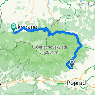
2010_09 Nová Lesná_Reinerova chata_Tatranská Lesná pěšky
- 15.6 km
- 647 m
- 485 m
- Nová Lesná, Prešov Region, Slovakia
A cycling route starting in Nová Lesná, Prešov Region, Slovakia.
Overview
From Alsóerdőfalva to Poprád Lake (1495m) by bike on pleasant asphalt roads, then on foot along the red trail to the top of Tengerszem (2500m).
created this 7 years ago
Continue with Bikemap
You would like to ride Bringás gyalogtúra Magas-Tátra I. nap or customize it for your own trip? Here is what you can do with this Bikemap route:
Free trial for 3 days, or one-time payment. More about Bikemap Premium.
Discover more Premium features.
Get Bikemap PremiumFrom our community
Open it in the app