

Vetriolo Terme CLONED FROM ROUTE 278588
A cycling route starting in Calceranica al Lago, Trentino-Alto Adige, Italy.
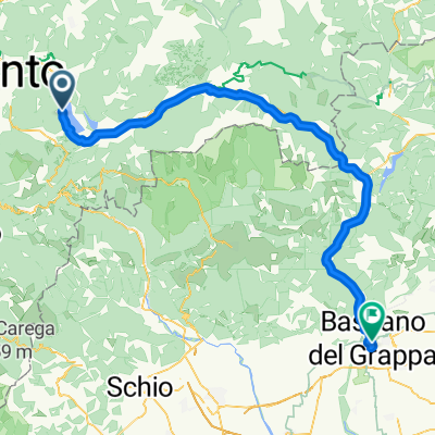
Overview
About this route
- -:--
- Duration
- 20.6 km
- Distance
- 288 m
- Ascent
- 284 m
- Descent
- ---
- Avg. speed
- ---
- Max. altitude
Continue with Bikemap
Use, edit, or download this cycling route
You would like to ride Vetriolo Terme CLONED FROM ROUTE 278588 or customize it for your own trip? Here is what you can do with this Bikemap route:
Free features
- Save this route as favorite or in collections
- Copy & plan your own version of this route
- Sync your route with Garmin or Wahoo
Premium features
Free trial for 3 days, or one-time payment. More about Bikemap Premium.
- Navigate this route on iOS & Android
- Export a GPX / KML file of this route
- Create your custom printout (try it for free)
- Download this route for offline navigation
Discover more Premium features.
Get Bikemap PremiumFrom our community
Other popular routes starting in Calceranica al Lago
 Von Selva di Levico nach Bassano del Grappa
- Distance
- 75 km
- Ascent
- 297 m
- Descent
- 648 m
- Location
- Calceranica al Lago, Trentino-Alto Adige, Italy
 4. Etappe Lago di Caldonazzo - Bassano
- Distance
- 79.5 km
- Ascent
- 946 m
- Descent
- 1,285 m
- Location
- Calceranica al Lago, Trentino-Alto Adige, Italy
 valsugana
- Distance
- 77.7 km
- Ascent
- 214 m
- Descent
- 558 m
- Location
- Calceranica al Lago, Trentino-Alto Adige, Italy
 Caldonazzo-Verona via L. di Garda
- Distance
- 119.8 km
- Ascent
- 676 m
- Descent
- 1,062 m
- Location
- Calceranica al Lago, Trentino-Alto Adige, Italy
 Caldonazzo_5
- Distance
- 25.8 km
- Ascent
- 217 m
- Descent
- 217 m
- Location
- Calceranica al Lago, Trentino-Alto Adige, Italy
 Caldonazzo_Bolzano
- Distance
- 86.3 km
- Ascent
- 633 m
- Descent
- 813 m
- Location
- Calceranica al Lago, Trentino-Alto Adige, Italy
 Etappe 1 Calceranica al Lago - Castello Tesino
- Distance
- 55 km
- Ascent
- 1,149 m
- Descent
- 799 m
- Location
- Calceranica al Lago, Trentino-Alto Adige, Italy
 Kaiserjager rondje 40km
- Distance
- 39.5 km
- Ascent
- 1,062 m
- Descent
- 1,062 m
- Location
- Calceranica al Lago, Trentino-Alto Adige, Italy
Open it in the app