

BUND-RadWandelTour 30.09.2018
A cycling route starting in Rahden, North Rhine-Westphalia, Germany.
Overview
About this route
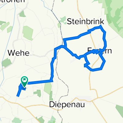
Rahden Train Station - Große Aue Renaturation Area - Schnakenpohl - Twiehauser Brook - Dreyer Organic Farm, Arrenkamp - Fenne Family Insect Garden, Arrenkamp - return to Rahden
Guided bike tour by BUND district association Minden-Lübbecke with Winrich Dodenhöft and Thomas Dippert
- -:--
- Duration
- 46.6 km
- Distance
- 64 m
- Ascent
- 64 m
- Descent
- ---
- Avg. speed
- ---
- Max. altitude

Route quality
Waytypes & surfaces along the route
Waytypes
Quiet road
33.5 km
(72 %)
Road
4.2 km
(9 %)
Surfaces
Paved
28.9 km
(62 %)
Unpaved
3.3 km
(7 %)
Paved (undefined)
16.3 km
(35 %)
Asphalt
12.6 km
(27 %)
Continue with Bikemap
Use, edit, or download this cycling route
You would like to ride BUND-RadWandelTour 30.09.2018 or customize it for your own trip? Here is what you can do with this Bikemap route:
Free features
- Save this route as favorite or in collections
- Copy & plan your own version of this route
- Sync your route with Garmin or Wahoo
Premium features
Free trial for 3 days, or one-time payment. More about Bikemap Premium.
- Navigate this route on iOS & Android
- Export a GPX / KML file of this route
- Create your custom printout (try it for free)
- Download this route for offline navigation
Discover more Premium features.
Get Bikemap PremiumFrom our community
Other popular routes starting in Rahden
 From Rahden to Brockum
- Distance
- 36.7 km
- Ascent
- 203 m
- Descent
- 191 m
- Location
- Rahden, North Rhine-Westphalia, Germany
 Route in Rahden
- Distance
- 62 km
- Ascent
- 83 m
- Descent
- 84 m
- Location
- Rahden, North Rhine-Westphalia, Germany
 Tonnenheider Runde 2
- Distance
- 18.2 km
- Ascent
- 36 m
- Descent
- 40 m
- Location
- Rahden, North Rhine-Westphalia, Germany
 Rahden-Pr.Ströhen-Tonnenheide-Rahden
- Distance
- 39 km
- Ascent
- 30 m
- Descent
- 28 m
- Location
- Rahden, North Rhine-Westphalia, Germany
 BUND-RadWandelTour 30.09.2018
- Distance
- 46.6 km
- Ascent
- 64 m
- Descent
- 64 m
- Location
- Rahden, North Rhine-Westphalia, Germany
 Röstgrad (Rahden) - Petershagen
- Distance
- 25.9 km
- Ascent
- 61 m
- Descent
- 52 m
- Location
- Rahden, North Rhine-Westphalia, Germany
 1 Stunde Rahden West
- Distance
- 18.1 km
- Ascent
- 45 m
- Descent
- 45 m
- Location
- Rahden, North Rhine-Westphalia, Germany
 Garten-Radtour 2022-06-24
- Distance
- 30.4 km
- Ascent
- 88 m
- Descent
- 86 m
- Location
- Rahden, North Rhine-Westphalia, Germany
Open it in the app