

Hochschwab csoport 2
A cycling route starting in Palfau, Styria, Austria.
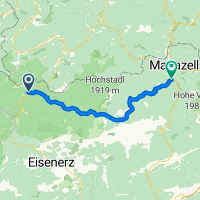
Overview
About this route
Salza völgye
Wasserlochklamm
Wasserloch
Jägerriedel
Salza völgye
- -:--
- Duration
- 3.6 km
- Distance
- 396 m
- Ascent
- 396 m
- Descent
- ---
- Avg. speed
- ---
- Max. altitude

Continue with Bikemap
Use, edit, or download this cycling route
You would like to ride Hochschwab csoport 2 or customize it for your own trip? Here is what you can do with this Bikemap route:
Free features
- Save this route as favorite or in collections
- Copy & plan your own version of this route
- Sync your route with Garmin or Wahoo
Premium features
Free trial for 3 days, or one-time payment. More about Bikemap Premium.
- Navigate this route on iOS & Android
- Export a GPX / KML file of this route
- Create your custom printout (try it for free)
- Download this route for offline navigation
Discover more Premium features.
Get Bikemap PremiumFrom our community
Other popular routes starting in Palfau
 Hochschwab csoport 2
- Distance
- 3.6 km
- Ascent
- 396 m
- Descent
- 396 m
- Location
- Palfau, Styria, Austria
 Alpentour, Palfau-Mariazell
- Distance
- 71.4 km
- Ascent
- 1,375 m
- Descent
- 1,031 m
- Location
- Palfau, Styria, Austria
 Palfau->Admont->Weissenwasser
- Distance
- 87.4 km
- Ascent
- 1,347 m
- Descent
- 1,273 m
- Location
- Palfau, Styria, Austria
 4 – Die steilen Bergwände des Gesäuse
- Distance
- 38.6 km
- Ascent
- 728 m
- Descent
- 396 m
- Location
- Palfau, Styria, Austria
 Palfau 19 nach Grazer Straße 26, Mariazell
- Distance
- 59.3 km
- Ascent
- 2,166 m
- Descent
- 1,863 m
- Location
- Palfau, Styria, Austria
 Palfau nach Gußwerk und zurück
- Distance
- 53 km
- Ascent
- 711 m
- Descent
- 500 m
- Location
- Palfau, Styria, Austria
 Day 6 Austria
- Distance
- 60 km
- Ascent
- 854 m
- Descent
- 561 m
- Location
- Palfau, Styria, Austria
 Buchsteinrunde 2/3
- Distance
- 55.3 km
- Ascent
- 1,878 m
- Descent
- 1,544 m
- Location
- Palfau, Styria, Austria
Open it in the app