

Lyons Kleiner Bergstern
A cycling route starting in Sainte-Consorce, Auvergne-Rhône-Alpes, France.
Overview
About this route
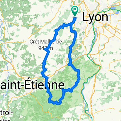
Short evening ride on quiet back roads in the slipstream of the major city Lyon up to the Col de Malval.
The climbs are frequent but only moderately challenging. The asphalt is not perfect everywhere but manageable for road bikes.
- -:--
- Duration
- 41.6 km
- Distance
- 682 m
- Ascent
- 681 m
- Descent
- ---
- Avg. speed
- ---
- Max. altitude
Route quality
Waytypes & surfaces along the route
Waytypes
Road
24.5 km
(59 %)
Quiet road
1.2 km
(3 %)
Surfaces
Paved
28.7 km
(69 %)
Asphalt
28.7 km
(69 %)
Undefined
12.9 km
(31 %)
Continue with Bikemap
Use, edit, or download this cycling route
You would like to ride Lyons Kleiner Bergstern or customize it for your own trip? Here is what you can do with this Bikemap route:
Free features
- Save this route as favorite or in collections
- Copy & plan your own version of this route
- Sync your route with Garmin or Wahoo
Premium features
Free trial for 3 days, or one-time payment. More about Bikemap Premium.
- Navigate this route on iOS & Android
- Export a GPX / KML file of this route
- Create your custom printout (try it for free)
- Download this route for offline navigation
Discover more Premium features.
Get Bikemap PremiumFrom our community
Other popular routes starting in Sainte-Consorce
 tour horaire des monts du Lyonnais
- Distance
- 108.4 km
- Ascent
- 1,418 m
- Descent
- 1,440 m
- Location
- Sainte-Consorce, Auvergne-Rhône-Alpes, France
 first try
- Distance
- 27 km
- Ascent
- 675 m
- Descent
- 666 m
- Location
- Sainte-Consorce, Auvergne-Rhône-Alpes, France
 marcy 1h vélo - col de la croix du ban
- Distance
- 21.4 km
- Ascent
- 402 m
- Descent
- 402 m
- Location
- Sainte-Consorce, Auvergne-Rhône-Alpes, France
 De 42 Chemin des Églantines, Marcy-l'Étoile à 16–180 Chemin des Alouettes, Vaugneray
- Distance
- 9.6 km
- Ascent
- 209 m
- Descent
- 168 m
- Location
- Sainte-Consorce, Auvergne-Rhône-Alpes, France
 Le pilat V2
- Distance
- 156 km
- Ascent
- 2,191 m
- Descent
- 2,197 m
- Location
- Sainte-Consorce, Auvergne-Rhône-Alpes, France
 dimanche
- Distance
- 34.7 km
- Ascent
- 815 m
- Descent
- 882 m
- Location
- Sainte-Consorce, Auvergne-Rhône-Alpes, France
 De Chemin de l'Hôpital 71F, Sainte-Consorce à Impasse Rivoire 5, Saint-Genis-Laval
- Distance
- 16.9 km
- Ascent
- 183 m
- Descent
- 314 m
- Location
- Sainte-Consorce, Auvergne-Rhône-Alpes, France
 VTT Monts Lyonnais - Chapel
- Distance
- 21.1 km
- Ascent
- 389 m
- Descent
- 390 m
- Location
- Sainte-Consorce, Auvergne-Rhône-Alpes, France
Open it in the app