

CVJM_Hütte_Villingen
A cycling route starting in Waldkirch, Baden-Wurttemberg, Germany.
Overview
About this route
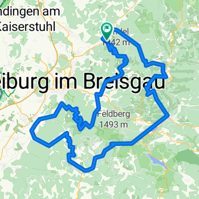
Waldkirch - CVJM_Hütte_Villingen
- -:--
- Duration
- 57.4 km
- Distance
- 1,109 m
- Ascent
- 631 m
- Descent
- ---
- Avg. speed
- ---
- Max. altitude

Route quality
Waytypes & surfaces along the route
Waytypes
Road
16.1 km
(28 %)
Track
14.4 km
(25 %)
Surfaces
Paved
33.3 km
(58 %)
Unpaved
10.9 km
(19 %)
Asphalt
30.4 km
(53 %)
Unpaved (undefined)
5.7 km
(10 %)
Continue with Bikemap
Use, edit, or download this cycling route
You would like to ride CVJM_Hütte_Villingen or customize it for your own trip? Here is what you can do with this Bikemap route:
Free features
- Save this route as favorite or in collections
- Copy & plan your own version of this route
- Sync your route with Garmin or Wahoo
Premium features
Free trial for 3 days, or one-time payment. More about Bikemap Premium.
- Navigate this route on iOS & Android
- Export a GPX / KML file of this route
- Create your custom printout (try it for free)
- Download this route for offline navigation
Discover more Premium features.
Get Bikemap PremiumFrom our community
Other popular routes starting in Waldkirch
 Kollnau - Elzach
- Distance
- 15.5 km
- Ascent
- 538 m
- Descent
- 284 m
- Location
- Waldkirch, Baden-Wurttemberg, Germany
 Scheibentreff Challenge 2017 Hillclimb
- Distance
- 10.6 km
- Ascent
- 996 m
- Descent
- 134 m
- Location
- Waldkirch, Baden-Wurttemberg, Germany
 Waldkirch-Kandel-Wildgutach
- Distance
- 87.6 km
- Ascent
- 1,628 m
- Descent
- 1,618 m
- Location
- Waldkirch, Baden-Wurttemberg, Germany
 Waldkirch-Kandel
- Distance
- 9.4 km
- Ascent
- 997 m
- Descent
- 69 m
- Location
- Waldkirch, Baden-Wurttemberg, Germany
 Allemagne : Titisee-Neustadt - Waldkirch
- Distance
- 199 km
- Ascent
- 4,698 m
- Descent
- 4,062 m
- Location
- Waldkirch, Baden-Wurttemberg, Germany
 Kollnau - Elzach
- Distance
- 15.6 km
- Ascent
- 506 m
- Descent
- 252 m
- Location
- Waldkirch, Baden-Wurttemberg, Germany
 Südschwarzwald
- Distance
- 192.9 km
- Ascent
- 6,091 m
- Descent
- 5,695 m
- Location
- Waldkirch, Baden-Wurttemberg, Germany
 Kandel Schwarzwald
- Distance
- 10.6 km
- Ascent
- 968 m
- Descent
- 102 m
- Location
- Waldkirch, Baden-Wurttemberg, Germany
Open it in the app