Crazy Taiwan Tour
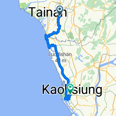
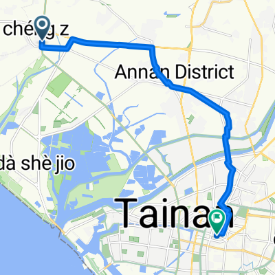
A cycling route starting in Tainan City, Taiwan, Taiwan.
Overview
About this route
Tour of Taiwan, from Tainan, will touch extream south, the highest road in Tainan, extream east, extream north, extream west and back to Tainan
- -:--
- Duration
- 1,228.2 km
- Distance
- 4,180 m
- Ascent
- 4,181 m
- Descent
- ---
- Avg. speed
- ---
- Max. altitude
Continue with Bikemap
Use, edit, or download this cycling route
You would like to ride Crazy Taiwan Tour or customize it for your own trip? Here is what you can do with this Bikemap route:
Free features
- Save this route as favorite or in collections
- Copy & plan your own version of this route
- Split it into stages to create a multi-day tour
- Sync your route with Garmin or Wahoo
Premium features
Free trial for 3 days, or one-time payment. More about Bikemap Premium.
- Navigate this route on iOS & Android
- Export a GPX / KML file of this route
- Create your custom printout (try it for free)
- Download this route for offline navigation
Discover more Premium features.
Get Bikemap PremiumFrom our community
Other popular routes starting in Tainan City
- 台南高鐵站至關廟森林公園
- Distance
- 25.7 km
- Ascent
- 115 m
- Descent
- 116 m
- Location
- Tainan City, Taiwan, Taiwan
- Crazy Taiwan Tour
- Distance
- 1,228.2 km
- Ascent
- 4,180 m
- Descent
- 4,181 m
- Location
- Tainan City, Taiwan, Taiwan
- 單車ing至玉井
- Distance
- 75.6 km
- Ascent
- 264 m
- Descent
- 267 m
- Location
- Tainan City, Taiwan, Taiwan
- 新化竹子腳(二)
- Distance
- 16.4 km
- Ascent
- 62 m
- Descent
- 61 m
- Location
- Tainan City, Taiwan, Taiwan
- 鹽水溪畔西行至四草大橋對岸
- Distance
- 17.1 km
- Ascent
- 34 m
- Descent
- 27 m
- Location
- Tainan City, Taiwan, Taiwan
- 新化山區小路
- Distance
- 33.2 km
- Ascent
- 1,061 m
- Descent
- 1,090 m
- Location
- Tainan City, Taiwan, Taiwan
- 6/29_Day5_台南-東港-住宿
- Distance
- 86.8 km
- Ascent
- 119 m
- Descent
- 141 m
- Location
- Tainan City, Taiwan, Taiwan
- 四草繞圈
- Distance
- 29.9 km
- Ascent
- 25 m
- Descent
- 28 m
- Location
- Tainan City, Taiwan, Taiwan
Open it in the app