Kippenheimweiler - Allmannweier
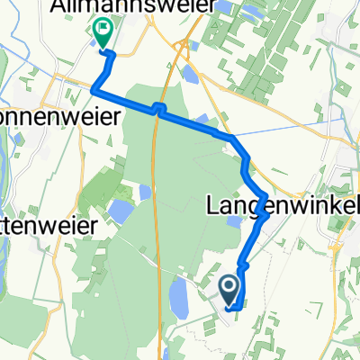
A cycling route starting in Kippenheim, Baden-Wurttemberg, Germany.
Overview
About this route
The route leads over paved and compacted gravel paths through forests, meadows, and fields to Allmannsweier.
- -:--
- Duration
- 8.1 km
- Distance
- 13 m
- Ascent
- 23 m
- Descent
- ---
- Avg. speed
- 165 m
- Max. altitude
Route quality
Waytypes & surfaces along the route
Waytypes
Path
3.5 km
(43 %)
Track
2 km
(24 %)
Surfaces
Paved
4.9 km
(60 %)
Unpaved
2.8 km
(35 %)
Asphalt
4.1 km
(50 %)
Gravel
1.3 km
(16 %)
Continue with Bikemap
Use, edit, or download this cycling route
You would like to ride Kippenheimweiler - Allmannweier or customize it for your own trip? Here is what you can do with this Bikemap route:
Free features
- Save this route as favorite or in collections
- Copy & plan your own version of this route
- Sync your route with Garmin or Wahoo
Premium features
Free trial for 3 days, or one-time payment. More about Bikemap Premium.
- Navigate this route on iOS & Android
- Export a GPX / KML file of this route
- Create your custom printout (try it for free)
- Download this route for offline navigation
Discover more Premium features.
Get Bikemap PremiumFrom our community
Other popular routes starting in Kippenheim
Sonntagmorgenrunde- Distance
- 67.2 km
- Ascent
- 997 m
- Descent
- 999 m
- Location
- Kippenheim, Baden-Wurttemberg, Germany
Kaiserswaldstraße, Lahr/Schwarzwald nach Im Stritacker 19, Lahr/Schwarzwald- Distance
- 8.8 km
- Ascent
- 0 m
- Descent
- 3 m
- Location
- Kippenheim, Baden-Wurttemberg, Germany
Kippenheim-Wurmlingen- Distance
- 109.6 km
- Ascent
- 910 m
- Descent
- 407 m
- Location
- Kippenheim, Baden-Wurttemberg, Germany
Kippenheim-Rhein-Rhonekanal- Distance
- 70.6 km
- Ascent
- 56 m
- Descent
- 56 m
- Location
- Kippenheim, Baden-Wurttemberg, Germany
Kippenheim-Rheinrunde- Distance
- 83.6 km
- Ascent
- 60 m
- Descent
- 60 m
- Location
- Kippenheim, Baden-Wurttemberg, Germany
Moderate Route in Kippenheim- Distance
- 14.7 km
- Ascent
- 828 m
- Descent
- 830 m
- Location
- Kippenheim, Baden-Wurttemberg, Germany
Am Waldmattensee 11, Lahr/Schwarzwald nach Kuhbacher Hauptstraße 11, Lahr/Schwarzwald- Distance
- 9.2 km
- Ascent
- 38 m
- Descent
- 14 m
- Location
- Kippenheim, Baden-Wurttemberg, Germany
Route in Lahr/Schwarzwald- Distance
- 76.5 km
- Ascent
- 410 m
- Descent
- 408 m
- Location
- Kippenheim, Baden-Wurttemberg, Germany
Open it in the app

