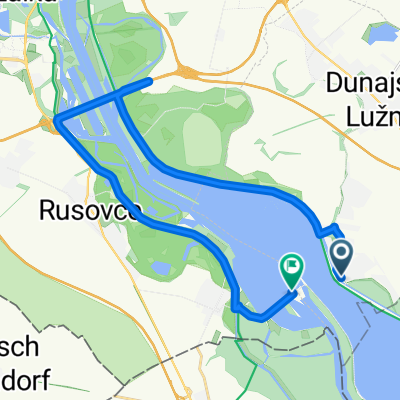
Rajka Danubiana múzeum - Bősi Vízerőmű 68km 2018.10.06.
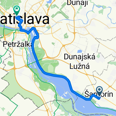
A cycling route starting in Šamorín, Trnava Region, Slovakia.
Overview
About this route
- 2 h 30 min
- Duration
- 68.5 km
- Distance
- 82 m
- Ascent
- 84 m
- Descent
- 27.4 km/h
- Avg. speed
- ---
- Max. altitude
Route quality
Waytypes & surfaces along the route
Waytypes
Cycleway
58.9 km
(86 %)
Road
2.7 km
(4 %)
Surfaces
Paved
63.7 km
(93 %)
Asphalt
63.7 km
(93 %)
Undefined
4.8 km
(7 %)
Continue with Bikemap
Use, edit, or download this cycling route
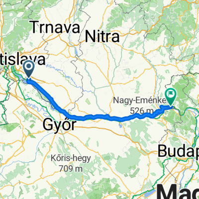
You would like to ride Rajka Danubiana múzeum - Bősi Vízerőmű 68km 2018.10.06. or customize it for your own trip? Here is what you can do with this Bikemap route:
Free features
- Save this route as favorite or in collections
- Copy & plan your own version of this route
- Sync your route with Garmin or Wahoo
Premium features
Free trial for 3 days, or one-time payment. More about Bikemap Premium.
- Navigate this route on iOS & Android
- Export a GPX / KML file of this route
- Create your custom printout (try it for free)
- Download this route for offline navigation
Discover more Premium features.
Get Bikemap PremiumFrom our community
Other popular routes starting in Šamorín
- Šamorín (Čilistov) - Šuľany / Horný Bar
- Distance
- 12.5 km
- Ascent
- 7 m
- Descent
- 10 m
- Location
- Šamorín, Trnava Region, Slovakia
- R: Okolo Hrušovskej zdrže a cez kompu (Kyselica - Prístavný most)
- Distance
- 62.6 km
- Ascent
- 29 m
- Descent
- 26 m
- Location
- Šamorín, Trnava Region, Slovakia
- Kyselica - Gabčíkovo a späť
- Distance
- 53.7 km
- Ascent
- 72 m
- Descent
- 72 m
- Location
- Šamorín, Trnava Region, Slovakia
- Čilistov X-BIONIC SPHERE-Kyselica-Horný Bar-Gabčíkovo-Čilistov X-BIONIC SPHERE
- Distance
- 50.8 km
- Ascent
- 33 m
- Descent
- 33 m
- Location
- Šamorín, Trnava Region, Slovakia
- Day 2 - Šamorín - Komárno
- Distance
- 80.4 km
- Ascent
- 75 m
- Descent
- 88 m
- Location
- Šamorín, Trnava Region, Slovakia
- 2. Čuňovo - Köszek_112km
- Distance
- 111.7 km
- Ascent
- 231 m
- Descent
- 89 m
- Location
- Šamorín, Trnava Region, Slovakia
- Burgenland
- Distance
- 225.1 km
- Ascent
- 268 m
- Descent
- 270 m
- Location
- Šamorín, Trnava Region, Slovakia
- najvacsi chill-smrt
- Distance
- 58.9 km
- Ascent
- 45 m
- Descent
- 48 m
- Location
- Šamorín, Trnava Region, Slovakia
Open it in the app