

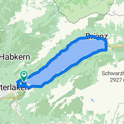
Interlaken - Lauterbrunnen
A cycling route starting in Bönigen, Canton of Bern, Switzerland.
Overview
About this route
- -:--
- Duration
- 41.7 km
- Distance
- 630 m
- Ascent
- 631 m
- Descent
- ---
- Avg. speed
- ---
- Max. altitude

Route quality
Waytypes & surfaces along the route
Waytypes
Quiet road
11.3 km
(27 %)
Track
7.1 km
(17 %)
Surfaces
Paved
31.7 km
(76 %)
Unpaved
5 km
(12 %)
Asphalt
29.6 km
(71 %)
Gravel
4.6 km
(11 %)
Continue with Bikemap
Use, edit, or download this cycling route
You would like to ride Interlaken - Lauterbrunnen or customize it for your own trip? Here is what you can do with this Bikemap route:
Free features
- Save this route as favorite or in collections
- Copy & plan your own version of this route
- Sync your route with Garmin or Wahoo
Premium features
Free trial for 3 days, or one-time payment. More about Bikemap Premium.
- Navigate this route on iOS & Android
- Export a GPX / KML file of this route
- Create your custom printout (try it for free)
- Download this route for offline navigation
Discover more Premium features.
Get Bikemap PremiumFrom our community
Other popular routes starting in Bönigen
 Tour du lac de Brienz
- Distance
- 36.7 km
- Ascent
- 417 m
- Descent
- 414 m
- Location
- Bönigen, Canton of Bern, Switzerland
 Bönigen-Aeschi-27km-610Hm
- Distance
- 27 km
- Ascent
- 798 m
- Descent
- 516 m
- Location
- Bönigen, Canton of Bern, Switzerland
 Brinzeress
- Distance
- 37.6 km
- Ascent
- 794 m
- Descent
- 797 m
- Location
- Bönigen, Canton of Bern, Switzerland
 Interlaken_1
- Distance
- 85.4 km
- Ascent
- 1,709 m
- Descent
- 1,707 m
- Location
- Bönigen, Canton of Bern, Switzerland
 Bonigen-Saxeten
- Distance
- 23 km
- Ascent
- 819 m
- Descent
- 679 m
- Location
- Bönigen, Canton of Bern, Switzerland
 Bödelitour
- Distance
- 21.8 km
- Ascent
- 174 m
- Descent
- 172 m
- Location
- Bönigen, Canton of Bern, Switzerland
 Große Scheidegg 22.8.2011
- Distance
- 80.1 km
- Ascent
- 1,467 m
- Descent
- 1,469 m
- Location
- Bönigen, Canton of Bern, Switzerland
 Bonigen-Burglaunen
- Distance
- 31.1 km
- Ascent
- 662 m
- Descent
- 656 m
- Location
- Bönigen, Canton of Bern, Switzerland
Open it in the app