

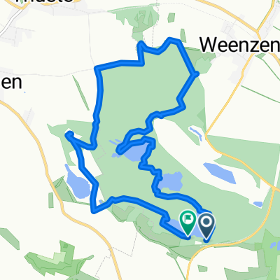
Humboldsee Salhemendorf Rundweg
A cycling route starting in Duingen, Lower Saxony, Germany.
Overview
About this route
Kammspitze Ith partially impassable.
- -:--
- Duration
- 33.1 km
- Distance
- 668 m
- Ascent
- 667 m
- Descent
- ---
- Avg. speed
- ---
- Max. altitude
Continue with Bikemap
Use, edit, or download this cycling route
You would like to ride Humboldsee Salhemendorf Rundweg or customize it for your own trip? Here is what you can do with this Bikemap route:
Free features
- Save this route as favorite or in collections
- Copy & plan your own version of this route
- Sync your route with Garmin or Wahoo
Premium features
Free trial for 3 days, or one-time payment. More about Bikemap Premium.
- Navigate this route on iOS & Android
- Export a GPX / KML file of this route
- Create your custom printout (try it for free)
- Download this route for offline navigation
Discover more Premium features.
Get Bikemap PremiumFrom our community
Other popular routes starting in Duingen
 Moderate Route in Duingen
- Distance
- 27.2 km
- Ascent
- 470 m
- Descent
- 480 m
- Location
- Duingen, Lower Saxony, Germany
 400-5
400-5- Distance
- 65.7 km
- Ascent
- 505 m
- Descent
- 608 m
- Location
- Duingen, Lower Saxony, Germany
 Bruchsee zurück
- Distance
- 18.6 km
- Ascent
- 374 m
- Descent
- 403 m
- Location
- Duingen, Lower Saxony, Germany
 Unter der Wulfseiche 30, Duingen nach Unter der Wulfseiche 30, Duingen
- Distance
- 7 km
- Ascent
- 73 m
- Descent
- 74 m
- Location
- Duingen, Lower Saxony, Germany
 hohgeiss
- Distance
- 110.7 km
- Ascent
- 1,137 m
- Descent
- 793 m
- Location
- Duingen, Lower Saxony, Germany
 Duinger Wald-Wilhelm Rabbe Turm
- Distance
- 32.5 km
- Ascent
- 434 m
- Descent
- 432 m
- Location
- Duingen, Lower Saxony, Germany
 9.11. Bruchsee
- Distance
- 10.6 km
- Ascent
- 117 m
- Descent
- 124 m
- Location
- Duingen, Lower Saxony, Germany
 Um die Ithwiesen
- Distance
- 18.4 km
- Ascent
- 288 m
- Descent
- 288 m
- Location
- Duingen, Lower Saxony, Germany
Open it in the app