

Bieszczady
Bieszczady - wodospad
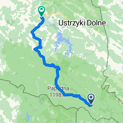
A cycling route starting in Lutowiska, Subcarpathian Voivodeship, Poland.
Overview
About this route
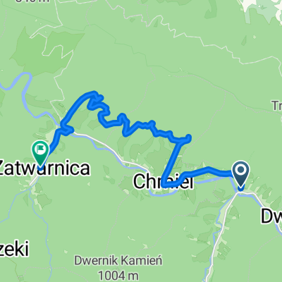
Chmiel - Zatwarnica - Szepit waterfall - Chmiel
- -:--
- Duration
- 11.3 km
- Distance
- 130 m
- Ascent
- 127 m
- Descent
- ---
- Avg. speed
- ---
- Max. altitude
Part of
Bieszczady
10 stages
Route quality
Waytypes & surfaces along the route
Waytypes
Road
8 km
(71 %)
Track
1.7 km
(15 %)
Surfaces
Paved
0.2 km
(2 %)
Unpaved
1.8 km
(16 %)
Gravel
1.7 km
(15 %)
Paved (undefined)
0.1 km
(1 %)
Continue with Bikemap
Use, edit, or download this cycling route
You would like to ride Bieszczady - wodospad or customize it for your own trip? Here is what you can do with this Bikemap route:
Free features
- Save this route as favorite or in collections
- Copy & plan your own version of this route
- Sync your route with Garmin or Wahoo
Premium features
Free trial for 3 days, or one-time payment. More about Bikemap Premium.
- Navigate this route on iOS & Android
- Export a GPX / KML file of this route
- Create your custom printout (try it for free)
- Download this route for offline navigation
Discover more Premium features.
Get Bikemap PremiumFrom our community
Other popular routes starting in Lutowiska
 Bieszczady - wodospad
- Distance
- 11.3 km
- Ascent
- 130 m
- Descent
- 127 m
- Location
- Lutowiska, Subcarpathian Voivodeship, Poland
 Otryt
Otryt- Distance
- 39.4 km
- Ascent
- 527 m
- Descent
- 527 m
- Location
- Lutowiska, Subcarpathian Voivodeship, Poland
 2013-08-15 Bieszczady. Rower. Wzdłuż Pasma Otrytu po obu stronach Sanu.
- Distance
- 45.3 km
- Ascent
- 632 m
- Descent
- 633 m
- Location
- Lutowiska, Subcarpathian Voivodeship, Poland
 Cyklotour 2015 - 1. deň
- Distance
- 61.3 km
- Ascent
- 647 m
- Descent
- 644 m
- Location
- Lutowiska, Subcarpathian Voivodeship, Poland
 Bieszczady-6
- Distance
- 36.1 km
- Ascent
- 716 m
- Descent
- 577 m
- Location
- Lutowiska, Subcarpathian Voivodeship, Poland
 Biesy - Dzien 3
- Distance
- 54 km
- Ascent
- 782 m
- Descent
- 805 m
- Location
- Lutowiska, Subcarpathian Voivodeship, Poland
 Od Ustrzyki Górne do Gmina Lesko
- Distance
- 71.6 km
- Ascent
- 1,387 m
- Descent
- 1,734 m
- Location
- Lutowiska, Subcarpathian Voivodeship, Poland
 Dwernik, Lutowiska do Zatwarnica, Lutowiska
- Distance
- 14.3 km
- Ascent
- 311 m
- Descent
- 306 m
- Location
- Lutowiska, Subcarpathian Voivodeship, Poland
Open it in the app