

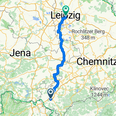
Eurobiketour - Dag 7
A cycling route starting in Bösenbrunn, Saxony, Germany.
Overview
About this route
- -:--
- Duration
- 75.1 km
- Distance
- 842 m
- Ascent
- 720 m
- Descent
- ---
- Avg. speed
- ---
- Max. altitude

Route quality
Waytypes & surfaces along the route
Waytypes
Road
29.8 km
(40 %)
Track
19.7 km
(26 %)
Surfaces
Paved
32.8 km
(44 %)
Unpaved
13.9 km
(18 %)
Asphalt
28.7 km
(38 %)
Gravel
8.7 km
(12 %)
Continue with Bikemap
Use, edit, or download this cycling route
You would like to ride Eurobiketour - Dag 7 or customize it for your own trip? Here is what you can do with this Bikemap route:
Free features
- Save this route as favorite or in collections
- Copy & plan your own version of this route
- Sync your route with Garmin or Wahoo
Premium features
Free trial for 3 days, or one-time payment. More about Bikemap Premium.
- Navigate this route on iOS & Android
- Export a GPX / KML file of this route
- Create your custom printout (try it for free)
- Download this route for offline navigation
Discover more Premium features.
Get Bikemap PremiumFrom our community
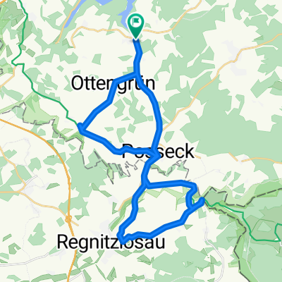
Other popular routes starting in Bösenbrunn
 Talsperre_Pirk_Plauen_Lochbauer_Plauen
- Distance
- 26.5 km
- Ascent
- 363 m
- Descent
- 347 m
- Location
- Bösenbrunn, Saxony, Germany
 Drödaer Straße 10, Bösenbrunn nach Drödaer Straße 10, Bösenbrunn
- Distance
- 20.3 km
- Ascent
- 303 m
- Descent
- 306 m
- Location
- Bösenbrunn, Saxony, Germany
 Taltitz - Leipzig 138 km
- Distance
- 137.7 km
- Ascent
- 398 m
- Descent
- 668 m
- Location
- Bösenbrunn, Saxony, Germany
 GT-TL Route3
- Distance
- 81.8 km
- Ascent
- 937 m
- Descent
- 937 m
- Location
- Bösenbrunn, Saxony, Germany
 Elsterradweg mit Points
- Distance
- 207.4 km
- Ascent
- 347 m
- Descent
- 703 m
- Location
- Bösenbrunn, Saxony, Germany
 Grenzland
- Distance
- 27.7 km
- Ascent
- 383 m
- Descent
- 367 m
- Location
- Bösenbrunn, Saxony, Germany
 Arbeitsweg
- Distance
- 32 km
- Ascent
- 307 m
- Descent
- 309 m
- Location
- Bösenbrunn, Saxony, Germany
 Drödaer Straße 10, Bösenbrunn nach Drödaer Straße 11, Bösenbrunn
- Distance
- 36.9 km
- Ascent
- 662 m
- Descent
- 664 m
- Location
- Bösenbrunn, Saxony, Germany
Open it in the app