
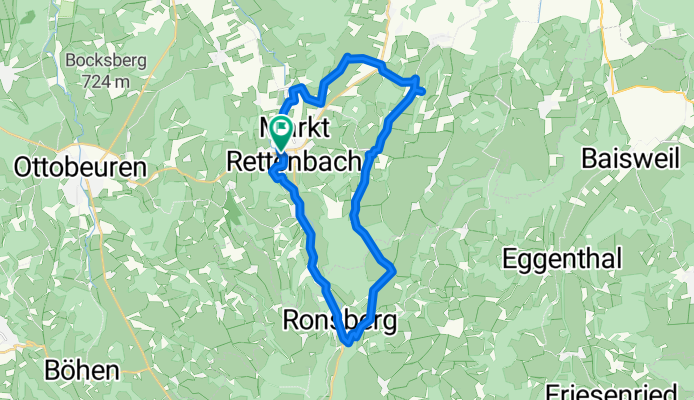
27,3_MRettenbach-Katzbrui-Ronsberg-MR
A cycling route starting in Markt Rettenbach, Bavaria, Germany.
Overview
About this route
- -:--
- Duration
- 27.3 km
- Distance
- 251 m
- Ascent
- 254 m
- Descent
- ---
- Avg. speed
- ---
- Max. altitude

Route quality
Waytypes & surfaces along the route
Waytypes
Quiet road
19.7 km
(72 %)
Cycleway
2.7 km
(10 %)
Surfaces
Paved
4.9 km
(18 %)
Unpaved
1.1 km
(4 %)
Asphalt
3.8 km
(14 %)
Paved (undefined)
1.1 km
(4 %)
Continue with Bikemap
Use, edit, or download this cycling route
You would like to ride 27,3_MRettenbach-Katzbrui-Ronsberg-MR or customize it for your own trip? Here is what you can do with this Bikemap route:
Free features
- Save this route as favorite or in collections
- Copy & plan your own version of this route
- Sync your route with Garmin or Wahoo
Premium features
Free trial for 3 days, or one-time payment. More about Bikemap Premium.
- Navigate this route on iOS & Android
- Export a GPX / KML file of this route
- Create your custom printout (try it for free)
- Download this route for offline navigation
Discover more Premium features.
Get Bikemap PremiumFrom our community
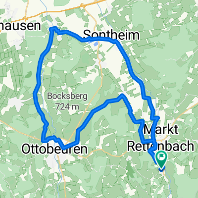
Other popular routes starting in Markt Rettenbach
 Engetried-Stetten-Sontheim-Engetried
- Distance
- 42.2 km
- Ascent
- 4,103 m
- Descent
- 4,099 m
- Location
- Markt Rettenbach, Bavaria, Germany
 Engetried-Sontheim-Westerheim-Ottobeuren-Frechenrieden u. zurück
- Distance
- 41.1 km
- Ascent
- 298 m
- Descent
- 301 m
- Location
- Markt Rettenbach, Bavaria, Germany
 Rennradrunde Markt Rettenbach-Durach-Feuerschwenden (Barmherzigkeitskapelle)-Kempten-Markt Rettenbach
- Distance
- 85 km
- Ascent
- 587 m
- Descent
- 586 m
- Location
- Markt Rettenbach, Bavaria, Germany
 Altisrieder Straße nach Altisrieder Straße
- Distance
- 27.5 km
- Ascent
- 225 m
- Descent
- 226 m
- Location
- Markt Rettenbach, Bavaria, Germany
 Günzrunde
- Distance
- 42 km
- Ascent
- 1,139 m
- Descent
- 1,138 m
- Location
- Markt Rettenbach, Bavaria, Germany
 Engetried-Moosmühle-Böhen-Ottobeuren u.zurück
- Distance
- 44.2 km
- Ascent
- 425 m
- Descent
- 424 m
- Location
- Markt Rettenbach, Bavaria, Germany
 Markt Rettenbach-Pfänders(Memmingen)
- Distance
- 40.9 km
- Ascent
- 452 m
- Descent
- 540 m
- Location
- Markt Rettenbach, Bavaria, Germany
 38,9_MRettenbach-Katzbrui-OGünzburg MR
- Distance
- 38.9 km
- Ascent
- 280 m
- Descent
- 283 m
- Location
- Markt Rettenbach, Bavaria, Germany
Open it in the app