

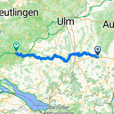
Mindelheim-Ottobeuren- Markt Rettenbach-Dirlewang-Mindelheim
A cycling route starting in Mindelheim, Bavaria, Germany.
Overview
About this route
- -:--
- Duration
- 45.9 km
- Distance
- 456 m
- Ascent
- 455 m
- Descent
- ---
- Avg. speed
- ---
- Avg. speed

Route quality
Waytypes & surfaces along the route
Waytypes
Quiet road
23.5 km
(51 %)
Busy road
7.9 km
(17 %)
Surfaces
Paved
19.6 km
(43 %)
Unpaved
3.2 km
(7 %)
Asphalt
14.5 km
(31 %)
Paved (undefined)
5 km
(11 %)
Continue with Bikemap
Use, edit, or download this cycling route
You would like to ride Mindelheim-Ottobeuren- Markt Rettenbach-Dirlewang-Mindelheim or customize it for your own trip? Here is what you can do with this Bikemap route:
Free features
- Save this route as favorite or in collections
- Copy & plan your own version of this route
- Sync your route with Garmin or Wahoo
Premium features
Free trial for 3 days, or one-time payment. More about Bikemap Premium.
- Navigate this route on iOS & Android
- Export a GPX / KML file of this route
- Create your custom printout (try it for free)
- Download this route for offline navigation
Discover more Premium features.
Get Bikemap PremiumFrom our community
Other popular routes starting in Mindelheim
 1. Etappe Mindelheim - Oberaudorf
- Distance
- 173.3 km
- Ascent
- 328 m
- Descent
- 448 m
- Location
- Mindelheim, Bavaria, Germany
 Allgäu-Unterallgäuer Biergartentour
- Distance
- 61.1 km
- Ascent
- 319 m
- Descent
- 320 m
- Location
- Mindelheim, Bavaria, Germany
 Mindelheim-Lindau
- Distance
- 97.1 km
- Ascent
- 311 m
- Descent
- 519 m
- Location
- Mindelheim, Bavaria, Germany
 MN Sigmaringen
- Distance
- 134.8 km
- Ascent
- 1,265 m
- Descent
- 1,297 m
- Location
- Mindelheim, Bavaria, Germany
 Mindelheim - Kronburg
- Distance
- 76.7 km
- Ascent
- 555 m
- Descent
- 539 m
- Location
- Mindelheim, Bavaria, Germany
 Allgäu - durch das Tal der Störche -Var
- Distance
- 65.4 km
- Ascent
- 742 m
- Descent
- 807 m
- Location
- Mindelheim, Bavaria, Germany
 Allgäu - Unterallg Gartentour-MN-MM-var4
- Distance
- 38.8 km
- Ascent
- 372 m
- Descent
- 381 m
- Location
- Mindelheim, Bavaria, Germany
 Elbsee (Alternativbier)
- Distance
- 78.3 km
- Ascent
- 742 m
- Descent
- 687 m
- Location
- Mindelheim, Bavaria, Germany
Open it in the app