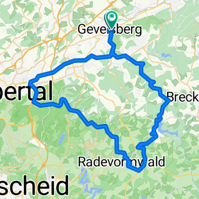
APM-Nordbahntrasse-Ruhrtal
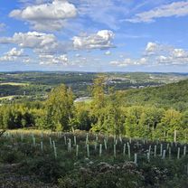
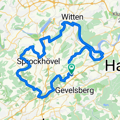
A cycling route starting in Gevelsberg, North Rhine-Westphalia, Germany.
Overview
About this route
- -:--
- Duration
- 119.6 km
- Distance
- 481 m
- Ascent
- 483 m
- Descent
- ---
- Avg. speed
- ---
- Max. altitude
Route quality
Waytypes & surfaces along the route
Waytypes
Path
78.9 km
(66 %)
Quiet road
15.5 km
(13 %)
Surfaces
Paved
95.7 km
(80 %)
Unpaved
16.7 km
(14 %)
Asphalt
94.5 km
(79 %)
Gravel
12 km
(10 %)
Continue with Bikemap
Use, edit, or download this cycling route
You would like to ride APM-Nordbahntrasse-Ruhrtal or customize it for your own trip? Here is what you can do with this Bikemap route:
Free features
- Save this route as favorite or in collections
- Copy & plan your own version of this route
- Split it into stages to create a multi-day tour
- Sync your route with Garmin or Wahoo
Premium features
Free trial for 3 days, or one-time payment. More about Bikemap Premium.
- Navigate this route on iOS & Android
- Export a GPX / KML file of this route
- Create your custom printout (try it for free)
- Download this route for offline navigation
Discover more Premium features.
Get Bikemap PremiumFrom our community
Other popular routes starting in Gevelsberg
- 2009.07.05 Gevelsberg
- Distance
- 37.9 km
- Ascent
- 603 m
- Descent
- 603 m
- Location
- Gevelsberg, North Rhine-Westphalia, Germany
- 71km RTF Tour de Ruhr 2011
- Distance
- 65.3 km
- Ascent
- 716 m
- Descent
- 718 m
- Location
- Gevelsberg, North Rhine-Westphalia, Germany
- Kleine Rund Gevelsberg/Wtal/Rade/Ennepetal
- Distance
- 57.2 km
- Ascent
- 410 m
- Descent
- 413 m
- Location
- Gevelsberg, North Rhine-Westphalia, Germany
- Rund tour zur kemnade hattingen und über die bahn trasse
- Distance
- 60.8 km
- Ascent
- 443 m
- Descent
- 443 m
- Location
- Gevelsberg, North Rhine-Westphalia, Germany
- APM-Nordbahntrasse-Ruhrtal
- Distance
- 119.6 km
- Ascent
- 481 m
- Descent
- 483 m
- Location
- Gevelsberg, North Rhine-Westphalia, Germany
- Asker Berg
- Distance
- 3.8 km
- Ascent
- 216 m
- Descent
- 9 m
- Location
- Gevelsberg, North Rhine-Westphalia, Germany
- KohlenbahnRadweg
- Distance
- 8 km
- Ascent
- 91 m
- Descent
- 70 m
- Location
- Gevelsberg, North Rhine-Westphalia, Germany
- Silschede-Ruhr
- Distance
- 18.3 km
- Ascent
- 307 m
- Descent
- 307 m
- Location
- Gevelsberg, North Rhine-Westphalia, Germany
Open it in the app