

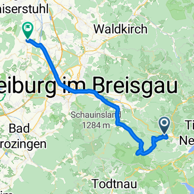
P(Hinterwaldkopf)-HöfenerHütte-P(Hinterwaldkopf)
A cycling route starting in Breitnau, Baden-Württemberg, Germany.
Overview
About this route
- -:--
- Duration
- 15.6 km
- Distance
- 467 m
- Ascent
- 467 m
- Descent
- ---
- Avg. speed
- ---
- Max. altitude
Route quality
Waytypes & surfaces along the route
Waytypes
Track
9 km
(57 %)
Access road
4.7 km
(30 %)
Surfaces
Paved
3.5 km
(22 %)
Unpaved
11.1 km
(71 %)
Gravel
11.1 km
(71 %)
Asphalt
3.5 km
(22 %)
Continue with Bikemap
Use, edit, or download this cycling route
You would like to ride P(Hinterwaldkopf)-HöfenerHütte-P(Hinterwaldkopf) or customize it for your own trip? Here is what you can do with this Bikemap route:
Free features
- Save this route as favorite or in collections
- Copy & plan your own version of this route
- Sync your route with Garmin or Wahoo
Premium features
Free trial for 3 days, or one-time payment. More about Bikemap Premium.
- Navigate this route on iOS & Android
- Export a GPX / KML file of this route
- Create your custom printout (try it for free)
- Download this route for offline navigation
Discover more Premium features.
Get Bikemap PremiumFrom our community
Other popular routes starting in Breitnau
 Breitnauer Sonnenrunde
- Distance
- 5.4 km
- Ascent
- 115 m
- Descent
- 115 m
- Location
- Breitnau, Baden-Württemberg, Germany
 Die Abfahrt nach Frankreich
- Distance
- 57.4 km
- Ascent
- 161 m
- Descent
- 976 m
- Location
- Breitnau, Baden-Württemberg, Germany
 Titi completti! Rundum glücklich. Und Hochfirst hinaus!
- Distance
- 52.4 km
- Ascent
- 920 m
- Descent
- 921 m
- Location
- Breitnau, Baden-Württemberg, Germany
 Tour de Sigi 2014
- Distance
- 199.1 km
- Ascent
- 3,710 m
- Descent
- 3,710 m
- Location
- Breitnau, Baden-Württemberg, Germany
 Weisstannenhöhe
- Distance
- 13.7 km
- Ascent
- 319 m
- Descent
- 318 m
- Location
- Breitnau, Baden-Württemberg, Germany
 Breitnau-Schauinsland-Todnau-Breitnau
- Distance
- 90 km
- Ascent
- 1,624 m
- Descent
- 1,625 m
- Location
- Breitnau, Baden-Württemberg, Germany
 Neustädter Höhenschlag
- Distance
- 68.3 km
- Ascent
- 1,053 m
- Descent
- 1,054 m
- Location
- Breitnau, Baden-Württemberg, Germany
 Breitnau - Kaiserstuhl
- Distance
- 46.4 km
- Ascent
- 492 m
- Descent
- 1,009 m
- Location
- Breitnau, Baden-Württemberg, Germany
Open it in the app