Rund um den Müggelsee
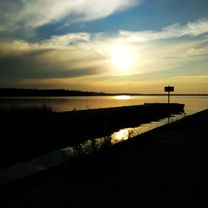
A cycling route starting in Köpenick, State of Berlin, Germany.
Overview
About this route
- 1 h 47 min
- Duration
- 38.2 km
- Distance
- 620 m
- Ascent
- 595 m
- Descent
- 21.4 km/h
- Avg. speed
- ---
- Max. altitude
Route photos
Route quality
Waytypes & surfaces along the route
Waytypes
Path
14.9 km
(39 %)
Quiet road
8.4 km
(22 %)
Surfaces
Paved
22.6 km
(59 %)
Unpaved
5 km
(13 %)
Asphalt
21.8 km
(57 %)
Gravel
3.1 km
(8 %)
Continue with Bikemap
Use, edit, or download this cycling route
You would like to ride Rund um den Müggelsee or customize it for your own trip? Here is what you can do with this Bikemap route:
Free features
- Save this route as favorite or in collections
- Copy & plan your own version of this route
- Sync your route with Garmin or Wahoo
Premium features
Free trial for 3 days, or one-time payment. More about Bikemap Premium.
- Navigate this route on iOS & Android
- Export a GPX / KML file of this route
- Create your custom printout (try it for free)
- Download this route for offline navigation
Discover more Premium features.
Get Bikemap PremiumFrom our community
Other popular routes starting in Köpenick
Müggelseerunde- Distance
- 28.6 km
- Ascent
- 51 m
- Descent
- 52 m
- Location
- Köpenick, State of Berlin, Germany
Teltowkanal-Treptow-Köpenick Rundfahrt- Distance
- 31.3 km
- Ascent
- 26 m
- Descent
- 26 m
- Location
- Köpenick, State of Berlin, Germany
Carl-Spindler-Straße 13, Berlin nach Carl-Spindler-Straße 11, Berlin- Distance
- 47.5 km
- Ascent
- 123 m
- Descent
- 128 m
- Location
- Köpenick, State of Berlin, Germany
th299 Köpenick-Wuhle-Börnicke-Bernau- Distance
- 45.8 km
- Ascent
- 244 m
- Descent
- 209 m
- Location
- Köpenick, State of Berlin, Germany
Rund um das Löcknitztal- Distance
- 94.9 km
- Ascent
- 231 m
- Descent
- 229 m
- Location
- Köpenick, State of Berlin, Germany
Ersatzrunde für Rund um den Scharmützelsee- Distance
- 134.6 km
- Ascent
- 353 m
- Descent
- 349 m
- Location
- Köpenick, State of Berlin, Germany
Müggelsee und Erkner- Distance
- 45.3 km
- Ascent
- 134 m
- Descent
- 131 m
- Location
- Köpenick, State of Berlin, Germany
Vom Bahnhof Köpenick zum Bhf. Hirschgarten- Distance
- 10 km
- Ascent
- 24 m
- Descent
- 25 m
- Location
- Köpenick, State of Berlin, Germany
Open it in the app


