An Eastern Riding
A cycling route starting in North Ferriby, England, United Kingdom.
Overview
About this route
- -:--
- Duration
- 22.5 km
- Distance
- 258 m
- Ascent
- 260 m
- Descent
- ---
- Avg. speed
- ---
- Avg. speed
Route quality
Waytypes & surfaces along the route
Waytypes
Road
11.3 km
(50 %)
Quiet road
9.2 km
(41 %)
Surfaces
Paved
16 km
(71 %)
Asphalt
16 km
(71 %)
Undefined
6.5 km
(29 %)
Continue with Bikemap
Use, edit, or download this cycling route
You would like to ride An Eastern Riding or customize it for your own trip? Here is what you can do with this Bikemap route:
Free features
- Save this route as favorite or in collections
- Copy & plan your own version of this route
- Sync your route with Garmin or Wahoo
Premium features
Free trial for 3 days, or one-time payment. More about Bikemap Premium.
- Navigate this route on iOS & Android
- Export a GPX / KML file of this route
- Create your custom printout (try it for free)
- Download this route for offline navigation
Discover more Premium features.
Get Bikemap PremiumFrom our community
Other popular routes starting in North Ferriby
- 7 Sykes Close, North Ferriby to 44 Sykes Close, North Ferriby
- Distance
- 7.6 km
- Ascent
- 169 m
- Descent
- 167 m
- Location
- North Ferriby, England, United Kingdom
- Plum Tree Cottage, 2 Plantation Dr, North Ferriby to St. Andrew's Ward, Hull
- Distance
- 19.9 km
- Ascent
- 60 m
- Descent
- 72 m
- Location
- North Ferriby, England, United Kingdom
- 22 High St, North Ferriby to Hesslewood Office Park, Ferriby Road, Hessle
- Distance
- 13.2 km
- Ascent
- 104 m
- Descent
- 109 m
- Location
- North Ferriby, England, United Kingdom
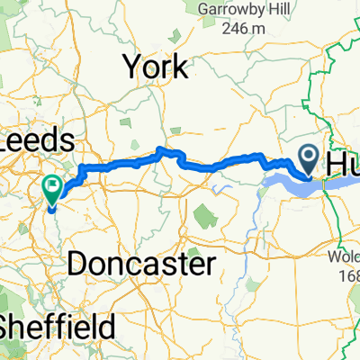
- 9 High Street, North Ferriby to 55 Manor Crescent, Wakefield
- Distance
- 89.2 km
- Ascent
- 276 m
- Descent
- 262 m
- Location
- North Ferriby, England, United Kingdom
- Ferriby 13mil
- Distance
- 19.3 km
- Ascent
- 239 m
- Descent
- 239 m
- Location
- North Ferriby, England, United Kingdom
- Swanland/Kidd Lane/Elloughton Dale/High Hunsley/Walkington/North Newbold(Bushey Hill/South Newbold/Trundlegate/ High Hunsley/ Riplingham/Raywell/Swanland.
- Distance
- 44.8 km
- Ascent
- 355 m
- Descent
- 368 m
- Location
- North Ferriby, England, United Kingdom
- The Manor House, 1 Woodgates Lane, North Ferriby to Uplands Cottage, 6 Woodgates Lane, North Ferriby
- Distance
- 13.9 km
- Ascent
- 156 m
- Descent
- 157 m
- Location
- North Ferriby, England, United Kingdom
- Plum Tree Cottage, 2 Plantation Dr, North Ferriby to 60 Humber St, Hull
- Distance
- 14.4 km
- Ascent
- 101 m
- Descent
- 111 m
- Location
- North Ferriby, England, United Kingdom
Open it in the app