

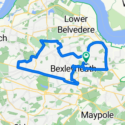
Plumstead to Lewes
A cycling route starting in Bexleyheath, England, United Kingdom.
Overview
About this route
- -:--
- Duration
- 80.4 km
- Distance
- 657 m
- Ascent
- 678 m
- Descent
- ---
- Avg. speed
- ---
- Max. altitude
Route quality
Waytypes & surfaces along the route
Waytypes
Busy road
30.6 km
(38 %)
Road
27.5 km
(34 %)
Surfaces
Paved
29 km
(36 %)
Unpaved
0.2 km
(<1 %)
Asphalt
27.8 km
(35 %)
Paved (undefined)
1.2 km
(1 %)
Continue with Bikemap
Use, edit, or download this cycling route
You would like to ride Plumstead to Lewes or customize it for your own trip? Here is what you can do with this Bikemap route:
Free features
- Save this route as favorite or in collections
- Copy & plan your own version of this route
- Split it into stages to create a multi-day tour
- Sync your route with Garmin or Wahoo
Premium features
Free trial for 3 days, or one-time payment. More about Bikemap Premium.
- Navigate this route on iOS & Android
- Export a GPX / KML file of this route
- Create your custom printout (try it for free)
- Download this route for offline navigation
Discover more Premium features.
Get Bikemap PremiumFrom our community
Other popular routes starting in Bexleyheath
 Bexleyheath urban escape
- Distance
- 29.9 km
- Ascent
- 221 m
- Descent
- 224 m
- Location
- Bexleyheath, England, United Kingdom
 Monday Morning Bike Ride
- Distance
- 21.2 km
- Ascent
- 102 m
- Descent
- 102 m
- Location
- Bexleyheath, England, United Kingdom
 Eltham 15KM MB
- Distance
- 15 km
- Ascent
- 84 m
- Descent
- 83 m
- Location
- Bexleyheath, England, United Kingdom
 Sunland Avenue 22 to Crook Log 37
- Distance
- 38.1 km
- Ascent
- 362 m
- Descent
- 364 m
- Location
- Bexleyheath, England, United Kingdom
 lon - ba
- Distance
- 1,720.1 km
- Ascent
- 873 m
- Descent
- 787 m
- Location
- Bexleyheath, England, United Kingdom
 Sterling Road 22 to Sterling Road 22
- Distance
- 20.7 km
- Ascent
- 153 m
- Descent
- 153 m
- Location
- Bexleyheath, England, United Kingdom
 New Bike Ride - Bexleyheath/Sidcup Loop
- Distance
- 18.3 km
- Ascent
- 137 m
- Descent
- 139 m
- Location
- Bexleyheath, England, United Kingdom
 Sterling Road 21 to Sterling Road 21
- Distance
- 27.3 km
- Ascent
- 223 m
- Descent
- 225 m
- Location
- Bexleyheath, England, United Kingdom
Open it in the app