

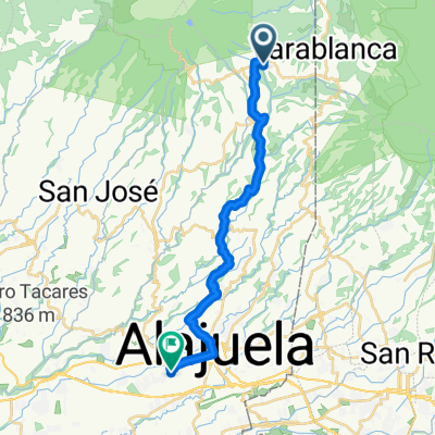
Subida volcan poas
A cycling route starting in Sabanilla, Alajuela Province, Costa Rica.
Overview
About this route
- -:--
- Duration
- 11 km
- Distance
- 807 m
- Ascent
- 588 m
- Descent
- ---
- Avg. speed
- ---
- Max. altitude

Route quality
Waytypes & surfaces along the route
Waytypes
Quiet road
10.6 km
(96 %)
Undefined
0.4 km
(4 %)
Surfaces
Paved
0.4 km
(4 %)
Asphalt
0.4 km
(4 %)
Undefined
10.6 km
(96 %)
Continue with Bikemap
Use, edit, or download this cycling route
You would like to ride Subida volcan poas or customize it for your own trip? Here is what you can do with this Bikemap route:
Free features
- Save this route as favorite or in collections
- Copy & plan your own version of this route
- Sync your route with Garmin or Wahoo
Premium features
Free trial for 3 days, or one-time payment. More about Bikemap Premium.
- Navigate this route on iOS & Android
- Export a GPX / KML file of this route
- Create your custom printout (try it for free)
- Download this route for offline navigation
Discover more Premium features.
Get Bikemap PremiumFrom our community
Other popular routes starting in Sabanilla
 Vulcan Paos - Alajuela
- Distance
- 26.3 km
- Ascent
- 102 m
- Descent
- 1,165 m
- Location
- Sabanilla, Alajuela Province, Costa Rica
 Poas - Platanar
- Distance
- 79.1 km
- Ascent
- 431 m
- Descent
- 2,618 m
- Location
- Sabanilla, Alajuela Province, Costa Rica
 MTB Beaches and Volcanos
- Distance
- 487.4 km
- Ascent
- 2,537 m
- Descent
- 4,491 m
- Location
- Sabanilla, Alajuela Province, Costa Rica
 Rough rides and beautiful beaches 15 days
- Distance
- 578.4 km
- Ascent
- 3,257 m
- Descent
- 4,079 m
- Location
- Sabanilla, Alajuela Province, Costa Rica
 Volcan Poas - Rio Cuarto
- Distance
- 44.1 km
- Ascent
- 350 m
- Descent
- 2,167 m
- Location
- Sabanilla, Alajuela Province, Costa Rica
 Relaxed route in
- Distance
- 38.2 km
- Ascent
- 1,207 m
- Descent
- 1,191 m
- Location
- Sabanilla, Alajuela Province, Costa Rica
 Fraijanes-Poasito-Vara Blanca-Cartagos-Carrizal-Canoas-Calle Ancha-Ceiba-Pilas-La Chaparra-Laguna Fraijanes-Fraijanes
- Distance
- 51.7 km
- Ascent
- 1,720 m
- Descent
- 1,718 m
- Location
- Sabanilla, Alajuela Province, Costa Rica
 Subida volcan poas
- Distance
- 11 km
- Ascent
- 807 m
- Descent
- 588 m
- Location
- Sabanilla, Alajuela Province, Costa Rica
Open it in the app