

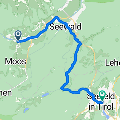
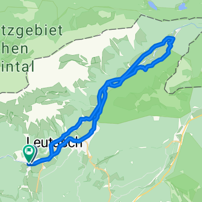
Leutasch - Gschnitz (am Brenner)
A cycling route starting in Leutasch, Tyrol, Austria.
Overview
About this route
Axel/Volker Bike Tour 2019
Stage 2
- -:--
- Duration
- 132.9 km
- Distance
- 2,310 m
- Ascent
- 2,223 m
- Descent
- ---
- Avg. speed
- ---
- Max. altitude

Route quality
Waytypes & surfaces along the route
Waytypes
Quiet road
12 km
(9 %)
Track
8 km
(6 %)
Surfaces
Paved
112.9 km
(85 %)
Unpaved
1.3 km
(1 %)
Asphalt
111.6 km
(84 %)
Paved (undefined)
1.3 km
(1 %)
Continue with Bikemap
Use, edit, or download this cycling route
You would like to ride Leutasch - Gschnitz (am Brenner) or customize it for your own trip? Here is what you can do with this Bikemap route:
Free features
- Save this route as favorite or in collections
- Copy & plan your own version of this route
- Split it into stages to create a multi-day tour
- Sync your route with Garmin or Wahoo
Premium features
Free trial for 3 days, or one-time payment. More about Bikemap Premium.
- Navigate this route on iOS & Android
- Export a GPX / KML file of this route
- Create your custom printout (try it for free)
- Download this route for offline navigation
Discover more Premium features.
Get Bikemap PremiumFrom our community
Other popular routes starting in Leutasch
 Leutasch nach Seefeld Kurpark
- Distance
- 11.5 km
- Ascent
- 331 m
- Descent
- 322 m
- Location
- Leutasch, Tyrol, Austria
 Ahrnspitzrunde Elmau Kranzbergrunde
- Distance
- 50.5 km
- Ascent
- 516 m
- Descent
- 519 m
- Location
- Leutasch, Tyrol, Austria
 MTB zum Seebensee
- Distance
- 34.4 km
- Ascent
- 633 m
- Descent
- 633 m
- Location
- Leutasch, Tyrol, Austria
 Hammermoosalm
- Distance
- 3.6 km
- Ascent
- 194 m
- Descent
- 250 m
- Location
- Leutasch, Tyrol, Austria
 Wettersteinrunde - Moser Tour Nr 37 CLONED FROM ROUTE 47855 CLONED FROM ROUTE 512664
- Distance
- 75.4 km
- Ascent
- 1,503 m
- Descent
- 1,503 m
- Location
- Leutasch, Tyrol, Austria
 von Leutasch zum Seebensee
- Distance
- 16.7 km
- Ascent
- 652 m
- Descent
- 171 m
- Location
- Leutasch, Tyrol, Austria
 Route im Leutaschtal
- Distance
- 9.5 km
- Ascent
- 133 m
- Descent
- 134 m
- Location
- Leutasch, Tyrol, Austria
 Gemütliche Fahrt
- Distance
- 25.9 km
- Ascent
- 258 m
- Descent
- 307 m
- Location
- Leutasch, Tyrol, Austria
Open it in the app