

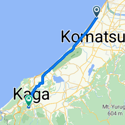
Komatsu Tetsujin Race 2018 Course
A cycling route starting in Komatsu, Ishikawa, Japan.
Overview
About this route
小松鉄人レース2018 60kmバイクコース
At kilometre 5 the course shown here is a little bit different from the real route because bikemaps was not able to find the road.
- -:--
- Duration
- 59.7 km
- Distance
- 338 m
- Ascent
- 338 m
- Descent
- ---
- Avg. speed
- ---
- Max. altitude

Route quality
Waytypes & surfaces along the route
Waytypes
Cycleway
15.5 km
(26 %)
Quiet road
10.7 km
(18 %)
Surfaces
Paved
15.5 km
(26 %)
Paved (undefined)
15.5 km
(26 %)
Undefined
44.2 km
(74 %)
Continue with Bikemap
Use, edit, or download this cycling route
You would like to ride Komatsu Tetsujin Race 2018 Course or customize it for your own trip? Here is what you can do with this Bikemap route:
Free features
- Save this route as favorite or in collections
- Copy & plan your own version of this route
- Sync your route with Garmin or Wahoo
Premium features
Free trial for 3 days, or one-time payment. More about Bikemap Premium.
- Navigate this route on iOS & Android
- Export a GPX / KML file of this route
- Create your custom printout (try it for free)
- Download this route for offline navigation
Discover more Premium features.
Get Bikemap PremiumFrom our community
Other popular routes starting in Komatsu
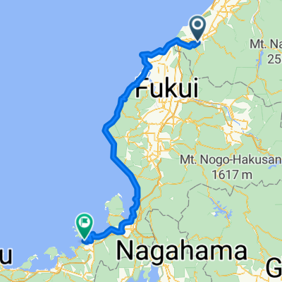
 Ohamamachi Ku, Nomi to Daishojishitayashikimachi, Kaga
- Distance
- 24.2 km
- Ascent
- 134 m
- Descent
- 134 m
- Location
- Komatsu, Ishikawa, Japan
 D6_a_Kaga > Suigekka
- Distance
- 150.2 km
- Ascent
- 2,919 m
- Descent
- 2,944 m
- Location
- Komatsu, Ishikawa, Japan
 Takigahara - Ataka Route (Komatsu-Kaga Bike Path)
- Distance
- 22.2 km
- Ascent
- 27 m
- Descent
- 21 m
- Location
- Komatsu, Ishikawa, Japan
 lkashla
- Distance
- 59.9 km
- Ascent
- 1,114 m
- Descent
- 985 m
- Location
- Komatsu, Ishikawa, Japan
 japonia kaga tokio
- Distance
- 612.6 km
- Ascent
- 3,095 m
- Descent
- 3,100 m
- Location
- Komatsu, Ishikawa, Japan
 百四丈の滝
百四丈の滝- Distance
- 80.1 km
- Ascent
- 888 m
- Descent
- 889 m
- Location
- Komatsu, Ishikawa, Japan
 Komatsu Tetsujin Race 2018 Course
- Distance
- 59.7 km
- Ascent
- 338 m
- Descent
- 338 m
- Location
- Komatsu, Ishikawa, Japan
 Recovered Route
- Distance
- 58.8 km
- Ascent
- 0 m
- Descent
- 3 m
- Location
- Komatsu, Ishikawa, Japan
Open it in the app