

Deutschlandtour Flensburg - Bodensee
E5 Quer durch Hessen
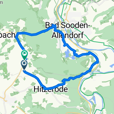
A cycling route starting in Bad Sooden-Allendorf, Hesse, Germany.
Overview
About this route
Once again, a long stage awaits, with the Hohen Meißner as another highlight of our crossing of Germany. After a warm-up, we tackle the Meißner, considered one of the toughest climbs in Hesse. The terrain remains hilly, but there are also longer stretches in the valley where rouleurs can showcase their strengths. From here on, we head directly south until, after 152 kilometers, we reach the stage finish at the 'Landhotel am Trätzhof' near Fulda.
- -:--
- Duration
- 151.8 km
- Distance
- 1,492 m
- Ascent
- 1,386 m
- Descent
- ---
- Avg. speed
- ---
- Max. altitude

Part of
Route quality
Waytypes & surfaces along the route
Waytypes
Road
45.5 km
(30 %)
Track
9.1 km
(6 %)
Surfaces
Paved
74.4 km
(49 %)
Unpaved
3 km
(2 %)
Asphalt
72.9 km
(48 %)
Gravel
3 km
(2 %)
Continue with Bikemap
Use, edit, or download this cycling route
You would like to ride E5 Quer durch Hessen or customize it for your own trip? Here is what you can do with this Bikemap route:
Free features
- Save this route as favorite or in collections
- Copy & plan your own version of this route
- Split it into stages to create a multi-day tour
- Sync your route with Garmin or Wahoo
Premium features
Free trial for 3 days, or one-time payment. More about Bikemap Premium.
- Navigate this route on iOS & Android
- Export a GPX / KML file of this route
- Create your custom printout (try it for free)
- Download this route for offline navigation
Discover more Premium features.
Get Bikemap PremiumFrom our community
Other popular routes starting in Bad Sooden-Allendorf

Edge1000®
Bad Sooden-Allendorf Cycling- Distance
- 12.4 km
- Ascent
- 8 m
- Descent
- 4 m
- Location
- Bad Sooden-Allendorf, Hesse, Germany
 Sonntagsruhe
- Distance
- 55.1 km
- Ascent
- 408 m
- Descent
- 403 m
- Location
- Bad Sooden-Allendorf, Hesse, Germany
 2020-08-22: Werra - Fulda
- Distance
- 97.7 km
- Ascent
- 774 m
- Descent
- 778 m
- Location
- Bad Sooden-Allendorf, Hesse, Germany
 Bikeführer MTB "Auf die Gobert"
- Distance
- 23.9 km
- Ascent
- 610 m
- Descent
- 527 m
- Location
- Bad Sooden-Allendorf, Hesse, Germany
 Große Hainstraße 2, Bad Sooden-Allendorf nach Weinreihe 5, Bad Sooden-Allendorf
- Distance
- 62.8 km
- Ascent
- 241 m
- Descent
- 250 m
- Location
- Bad Sooden-Allendorf, Hesse, Germany
 Bikeführer MTB "Zur Teufelskanzel"
- Distance
- 24.5 km
- Ascent
- 633 m
- Descent
- 543 m
- Location
- Bad Sooden-Allendorf, Hesse, Germany
 Bad Sooden 1
- Distance
- 14.3 km
- Ascent
- 253 m
- Descent
- 263 m
- Location
- Bad Sooden-Allendorf, Hesse, Germany
 Bad Sooden-Allendorf - Eichsfeld
- Distance
- 83.4 km
- Ascent
- 478 m
- Descent
- 478 m
- Location
- Bad Sooden-Allendorf, Hesse, Germany
Open it in the app