

Deutschlandtour Flensburg - Bodensee
E7 Hohenlohisches Steigenmassaker
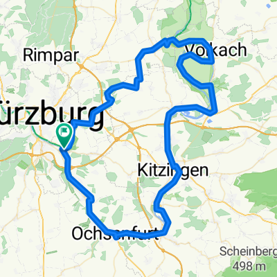
A cycling route starting in Randersacker, Bavaria, Germany.
Overview
About this route
The seventh stage is characterized by the deeply cut river valleys of the Hohenlohe plain as well as the wooded hills of the Swabian-Franconian Forest, along with several short but sometimes steep climbs. After rolling for a bit, we climb gently up to the Uengersbacher Höhe on the high plateau, cross the border into Baden-Württemberg, and then descend comfortably into the Tauber valley to Bad Mergentheim. The following climb through the Brunnenbach valley and the subsequent descent through the Erlenbach valley are still more easy riding than tough climbing. This changes upon reaching the Jagst valley, where the ramp to Neuhof awaits us; immediately afterwards, we ascend from the Kocher valley up to Eichach. Via Öhringen, we make our way into the Brettach valley and tackle the climb to Marienfels. The final mountain prize takes us up to the Juxkopf in the Löwensteiner Mountains, a well-known viewpoint, then only the descent remains to the stage town Winnenden and our 'Hotel Le Village'.
- -:--
- Duration
- 163.9 km
- Distance
- 1,159 m
- Ascent
- 1,039 m
- Descent
- ---
- Avg. speed
- ---
- Max. altitude

Part of
Route quality
Waytypes & surfaces along the route
Waytypes
Road
65.6 km
(40 %)
Quiet road
24.6 km
(15 %)
Surfaces
Paved
141 km
(86 %)
Asphalt
139.3 km
(85 %)
Paved (undefined)
1.6 km
(1 %)
Undefined
22.9 km
(14 %)
Continue with Bikemap
Use, edit, or download this cycling route
You would like to ride E7 Hohenlohisches Steigenmassaker or customize it for your own trip? Here is what you can do with this Bikemap route:
Free features
- Save this route as favorite or in collections
- Copy & plan your own version of this route
- Split it into stages to create a multi-day tour
- Sync your route with Garmin or Wahoo
Premium features
Free trial for 3 days, or one-time payment. More about Bikemap Premium.
- Navigate this route on iOS & Android
- Export a GPX / KML file of this route
- Create your custom printout (try it for free)
- Download this route for offline navigation
Discover more Premium features.
Get Bikemap PremiumFrom our community
Other popular routes starting in Randersacker
 Berner Straße 23, Würzburg nach St2312, Bischbrunn
- Distance
- 49.7 km
- Ascent
- 946 m
- Descent
- 865 m
- Location
- Randersacker, Bavaria, Germany
 Radtour 2019 - Version 2
- Distance
- 101.6 km
- Ascent
- 77 m
- Descent
- 83 m
- Location
- Randersacker, Bavaria, Germany
 Schloss Frankenberg
- Distance
- 86.4 km
- Ascent
- 309 m
- Descent
- 309 m
- Location
- Randersacker, Bavaria, Germany
 R_Wü_Ochsengrund
- Distance
- 59.5 km
- Ascent
- 367 m
- Descent
- 367 m
- Location
- Randersacker, Bavaria, Germany
 Radtour 2019 - Version
- Distance
- 91.8 km
- Ascent
- 156 m
- Descent
- 159 m
- Location
- Randersacker, Bavaria, Germany
 H'hof-Ochsenfurt-Acholshausen-Fuchsstadt-H'hof
- Distance
- 33.3 km
- Ascent
- 256 m
- Descent
- 255 m
- Location
- Randersacker, Bavaria, Germany
 Heuchelhof-Sommerhausen-Heuchelhof
- Distance
- 28.3 km
- Ascent
- 179 m
- Descent
- 179 m
- Location
- Randersacker, Bavaria, Germany
 Route in Würzburg
- Distance
- 62.4 km
- Ascent
- 575 m
- Descent
- 574 m
- Location
- Randersacker, Bavaria, Germany
Open it in the app