
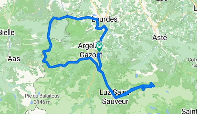
Tour de France 2019
A cycling route starting in Argelès-Gazost, Occitanie, France.
Overview
About this route
- -:--
- Duration
- 142.1 km
- Distance
- 3,014 m
- Ascent
- 2,992 m
- Descent
- ---
- Avg. speed
- ---
- Max. altitude

Route quality
Waytypes & surfaces along the route
Waytypes
Road
31.3 km
(22 %)
Quiet road
12.8 km
(9 %)
Surfaces
Paved
88.1 km
(62 %)
Unpaved
9.9 km
(7 %)
Asphalt
85.3 km
(60 %)
Ground
7.1 km
(5 %)
Continue with Bikemap
Use, edit, or download this cycling route
You would like to ride Tour de France 2019 or customize it for your own trip? Here is what you can do with this Bikemap route:
Free features
- Save this route as favorite or in collections
- Copy & plan your own version of this route
- Split it into stages to create a multi-day tour
- Sync your route with Garmin or Wahoo
Premium features
Free trial for 3 days, or one-time payment. More about Bikemap Premium.
- Navigate this route on iOS & Android
- Export a GPX / KML file of this route
- Create your custom printout (try it for free)
- Download this route for offline navigation
Discover more Premium features.
Get Bikemap PremiumFrom our community
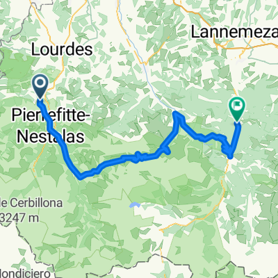
Other popular routes starting in Argelès-Gazost
 Argelès-Gazost - cirque de Troumousse - Argelès-Gazost
- Distance
- 117.9 km
- Ascent
- 2,264 m
- Descent
- 2,264 m
- Location
- Argelès-Gazost, Occitanie, France
 HPSV E6 9sep.
- Distance
- 86.2 km
- Ascent
- 2,322 m
- Descent
- 2,128 m
- Location
- Argelès-Gazost, Occitanie, France
 R4K PC2012 Dag 2 Groep B
- Distance
- 60.7 km
- Ascent
- 1,474 m
- Descent
- 1,474 m
- Location
- Argelès-Gazost, Occitanie, France
 V13 Col de Couraduque
- Distance
- 16.3 km
- Ascent
- 963 m
- Descent
- 40 m
- Location
- Argelès-Gazost, Occitanie, France
 R4K PC2012 dag 3 Groep A
- Distance
- 125.7 km
- Ascent
- 2,408 m
- Descent
- 2,409 m
- Location
- Argelès-Gazost, Occitanie, France
 Pirineos Spandelle-Aubisque
- Distance
- 79.2 km
- Ascent
- 2,607 m
- Descent
- 2,605 m
- Location
- Argelès-Gazost, Occitanie, France
 Argeles-Gazost- Lanus
- Distance
- 114.3 km
- Ascent
- 3,302 m
- Descent
- 3,296 m
- Location
- Argelès-Gazost, Occitanie, France
 R4K PC2012 Dag 1 middag
- Distance
- 37.4 km
- Ascent
- 1,245 m
- Descent
- 1,244 m
- Location
- Argelès-Gazost, Occitanie, France
Open it in the app