

Moschel Col Palazo
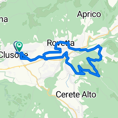
A cycling route starting in Clusone, Lombardy, Italy.
Overview
About this route
Beautiful route, but after the Baite del Moschel towards Col Palazzo it is barely rideable for 20 to 25 minutes.
- -:--
- Duration
- 30.4 km
- Distance
- 1,036 m
- Ascent
- 1,042 m
- Descent
- ---
- Avg. speed
- ---
- Max. altitude

Continue with Bikemap
Use, edit, or download this cycling route
You would like to ride Moschel Col Palazo or customize it for your own trip? Here is what you can do with this Bikemap route:
Free features
- Save this route as favorite or in collections
- Copy & plan your own version of this route
- Sync your route with Garmin or Wahoo
Premium features
Free trial for 3 days, or one-time payment. More about Bikemap Premium.
- Navigate this route on iOS & Android
- Export a GPX / KML file of this route
- Create your custom printout (try it for free)
- Download this route for offline navigation
Discover more Premium features.
Get Bikemap PremiumFrom our community
Other popular routes starting in Clusone
 Bossico Ceratello Sovere
- Distance
- 48.8 km
- Ascent
- 945 m
- Descent
- 948 m
- Location
- Clusone, Lombardy, Italy
 Falecchio Onore
- Distance
- 16.5 km
- Ascent
- 347 m
- Descent
- 346 m
- Location
- Clusone, Lombardy, Italy
 Moschel Col Palazo
- Distance
- 30.4 km
- Ascent
- 1,036 m
- Descent
- 1,042 m
- Location
- Clusone, Lombardy, Italy
 Gorno Parre Clusone
- Distance
- 26.7 km
- Ascent
- 515 m
- Descent
- 516 m
- Location
- Clusone, Lombardy, Italy
 Clusone Ciclabile 1
- Distance
- 8 km
- Ascent
- 104 m
- Descent
- 104 m
- Location
- Clusone, Lombardy, Italy
 Castel Orsetto Magnolini
- Distance
- 25.3 km
- Ascent
- 1,097 m
- Descent
- 128 m
- Location
- Clusone, Lombardy, Italy
 Falecchio Cappella Alpini Fino
- Distance
- 20.5 km
- Ascent
- 586 m
- Descent
- 583 m
- Location
- Clusone, Lombardy, Italy
 Ciclovia Alta Val Seriana
- Distance
- 30.5 km
- Ascent
- 492 m
- Descent
- 246 m
- Location
- Clusone, Lombardy, Italy
Open it in the app