
Ruta de montaña
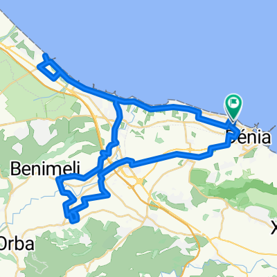
A cycling route starting in Denia, Valencia, Spain.
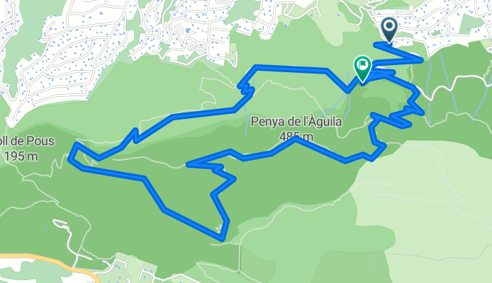
Overview
About this route
REFERENCE POINTS :
Crossing of Cova de L'aigua
The Eagle Peak (where we stopped for lunch)
Camí de la Colonia
- -:--
- Duration
- 8.2 km
- Distance
- 703 m
- Ascent
- 621 m
- Descent
- ---
- Avg. speed
- ---
- Max. altitude

Route highlights
Points of interest along the route
Point of interest after 0 km
Punto de Salida
Point of interest after 8.2 km
Final de la ruta
Continue with Bikemap
Use, edit, or download this cycling route
You would like to ride Ruta de montaña or customize it for your own trip? Here is what you can do with this Bikemap route:
Free features
- Save this route as favorite or in collections
- Copy & plan your own version of this route
- Sync your route with Garmin or Wahoo
Premium features
Free trial for 3 days, or one-time payment. More about Bikemap Premium.
- Navigate this route on iOS & Android
- Export a GPX / KML file of this route
- Create your custom printout (try it for free)
- Download this route for offline navigation
Discover more Premium features.
Get Bikemap PremiumFrom our community
Other popular routes starting in Denia
 Salida 9-11-2011 TCAF "A" (Pueblo Fantasma)
- Distance
- 16 km
- Ascent
- 225 m
- Descent
- 224 m
- Location
- Denia, Valencia, Spain
 Salida montaña
- Distance
- 7.7 km
- Ascent
- 791 m
- Descent
- 787 m
- Location
- Denia, Valencia, Spain
 DENIA- JESÚS POBRE- GATA- LA XARA- DENIA
- Distance
- 41.3 km
- Ascent
- 475 m
- Descent
- 474 m
- Location
- Denia, Valencia, Spain
 2016-08agosto-13 - FAMORCA
- Distance
- 108.2 km
- Ascent
- 1,033 m
- Descent
- 1,032 m
- Location
- Denia, Valencia, Spain
 Ruta Pico de L'Aguila
- Distance
- 6.8 km
- Ascent
- 574 m
- Descent
- 512 m
- Location
- Denia, Valencia, Spain
 Denia-Vuelta Montgo
- Distance
- 47.1 km
- Ascent
- 298 m
- Descent
- 294 m
- Location
- Denia, Valencia, Spain
 Ruta Pico del Águila
- Distance
- 9.2 km
- Ascent
- 598 m
- Descent
- 601 m
- Location
- Denia, Valencia, Spain
 9ijo..gracias. 9n.mmmlll.De Carrer Bacallà a Carrer Bacallà
- Distance
- 52.1 km
- Ascent
- 248 m
- Descent
- 247 m
- Location
- Denia, Valencia, Spain
Open it in the app