

02:Nierswalde-Woold
A cycling route starting in Kalkar, North Rhine-Westphalia, Germany.
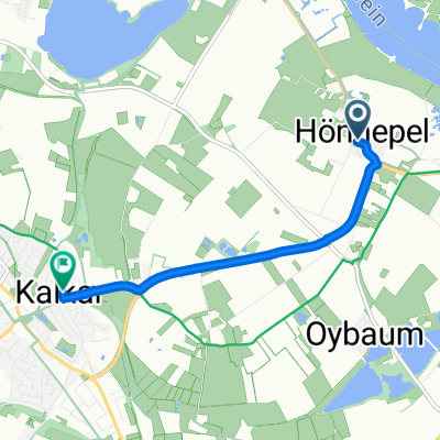
Overview
About this route
Fähre Griet-Grietherort
afvaarten alle dagen m.u.v. maandag (vak. NRW 27/8) www.niederrheinfaehre.de
Inseltreue: Grieth-Grieterhorst wo/vr/za/zo 10-19
Räässe Pöntje: Rees-Reeserschanz idem 10-19
Camping de Bosrand
B&B € 57,00 Logis
Heisestraat 14
7078 BM Megchelen
0315-377264 / 0613144178
campingdebosrand.eu
UMH Ulfts Museum Hotel
Dierenriem 42
7071 TH Ulft
0641160315
Ferien und Campingpark Wisseler See
Trekkinghütten
Wissel (Kalkar)
- -:--
- Duration
- 72.9 km
- Distance
- 76 m
- Ascent
- 66 m
- Descent
- ---
- Avg. speed
- ---
- Max. altitude

Route quality
Waytypes & surfaces along the route
Waytypes
Path
36.2 km
(50 %)
Quiet road
16.7 km
(23 %)
Surfaces
Paved
37.4 km
(51 %)
Unpaved
15.7 km
(22 %)
Asphalt
31.3 km
(43 %)
Loose gravel
11.6 km
(16 %)
Continue with Bikemap
Use, edit, or download this cycling route
You would like to ride 02:Nierswalde-Woold or customize it for your own trip? Here is what you can do with this Bikemap route:
Free features
- Save this route as favorite or in collections
- Copy & plan your own version of this route
- Sync your route with Garmin or Wahoo
Premium features
Free trial for 3 days, or one-time payment. More about Bikemap Premium.
- Navigate this route on iOS & Android
- Export a GPX / KML file of this route
- Create your custom printout (try it for free)
- Download this route for offline navigation
Discover more Premium features.
Get Bikemap PremiumFrom our community
Other popular routes starting in Kalkar
 Von Kalkar bis Rees
- Distance
- 7.4 km
- Ascent
- 6 m
- Descent
- 0 m
- Location
- Kalkar, North Rhine-Westphalia, Germany
 Kalkar 1
- Distance
- 9.8 km
- Ascent
- 4 m
- Descent
- 9 m
- Location
- Kalkar, North Rhine-Westphalia, Germany
 Gartentour Kleverland
- Distance
- 42.1 km
- Ascent
- 77 m
- Descent
- 77 m
- Location
- Kalkar, North Rhine-Westphalia, Germany
 Kehrum - Grieth - Rees - Wardt - Kehrum
- Distance
- 41.5 km
- Ascent
- 52 m
- Descent
- 52 m
- Location
- Kalkar, North Rhine-Westphalia, Germany
 Kalkar-Moyland- Rees-Bislich-Xanten-Kalkar
- Distance
- 62.2 km
- Ascent
- 45 m
- Descent
- 53 m
- Location
- Kalkar, North Rhine-Westphalia, Germany
 Kalkar-Emmerich-Elten-Zevenaar-Zeddam-s.Heerenberg-Emmerich-Kalkar
- Distance
- 78.2 km
- Ascent
- 196 m
- Descent
- 195 m
- Location
- Kalkar, North Rhine-Westphalia, Germany
 Grieth-Xanten-Rees
- Distance
- 43 km
- Ascent
- 61 m
- Descent
- 54 m
- Location
- Kalkar, North Rhine-Westphalia, Germany
 Route zu Kalkar Marktplatz
- Distance
- 4.2 km
- Ascent
- 3 m
- Descent
- 0 m
- Location
- Kalkar, North Rhine-Westphalia, Germany
Open it in the app