

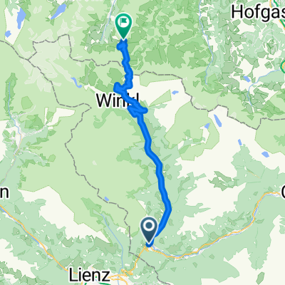
KR_04_Iselsberg_Hermagor_Vorderberg
A cycling route starting in Winklern, Carinthia, Austria.
Overview
About this route
Gefahren am 4. Juni 2019. Drau Radweg von Lienz bis Oberdrauburg perfekt zu fahren. Von Oberdrauburg über den Gailberg nach Kötschach, dies ist eine notwendige Verbindung um den Gailtal Radweg genießen zu können. Die folgende km bis zum Gasthaus Schermann sind empfehlenswert, abseits von motorisierten Verkehr in schöner Natur entspanntes Radfahren. Der Anstieg nach St. Paul ist Anspruchsvoll.
- -:--
- Duration
- 87 km
- Distance
- 464 m
- Ascent
- 1,039 m
- Descent
- ---
- Avg. speed
- ---
- Max. altitude

Route quality
Waytypes & surfaces along the route
Waytypes
Cycleway
26.5 km
(30 %)
Busy road
18.9 km
(22 %)
Surfaces
Paved
55 km
(63 %)
Unpaved
12.4 km
(14 %)
Asphalt
54.2 km
(62 %)
Gravel
12.4 km
(14 %)
Continue with Bikemap
Use, edit, or download this cycling route
You would like to ride KR_04_Iselsberg_Hermagor_Vorderberg or customize it for your own trip? Here is what you can do with this Bikemap route:
Free features
- Save this route as favorite or in collections
- Copy & plan your own version of this route
- Split it into stages to create a multi-day tour
- Sync your route with Garmin or Wahoo
Premium features
Free trial for 3 days, or one-time payment. More about Bikemap Premium.
- Navigate this route on iOS & Android
- Export a GPX / KML file of this route
- Create your custom printout (try it for free)
- Download this route for offline navigation
Discover more Premium features.
Get Bikemap PremiumFrom our community
Other popular routes starting in Winklern
 Großglocknertour 2008 - Tag 2
- Distance
- 74 km
- Ascent
- 2,408 m
- Descent
- 2,575 m
- Location
- Winklern, Carinthia, Austria
 GROSSGLOCKNER Hochalpenstrasse: Franz Josef Hohe - ?
- Distance
- 79.2 km
- Ascent
- 1,558 m
- Descent
- 1,560 m
- Location
- Winklern, Carinthia, Austria
 RR-Berg: Grossglockner KURZ (Winklern-Heiligenblut-Hochtor-Edelweissspitze)
- Distance
- 45.3 km
- Ascent
- 1,992 m
- Descent
- 370 m
- Location
- Winklern, Carinthia, Austria
 Itálie 1999 - 4. etapa (1.8.1999) CLONED FROM ROUTE 304686
- Distance
- 128.6 km
- Ascent
- 1,248 m
- Descent
- 2,270 m
- Location
- Winklern, Carinthia, Austria
 3 - Winklern - Heiligenblut
- Distance
- 25 km
- Ascent
- 607 m
- Descent
- 190 m
- Location
- Winklern, Carinthia, Austria
 Großglockner
- Distance
- 90.3 km
- Ascent
- 2,197 m
- Descent
- 2,197 m
- Location
- Winklern, Carinthia, Austria
 KR_04_Iselsberg_Hermagor_Vorderberg
- Distance
- 87 km
- Ascent
- 464 m
- Descent
- 1,039 m
- Location
- Winklern, Carinthia, Austria
 Mi10 Winklern - Heiligenblut 22+22 330HM
- Distance
- 21.6 km
- Ascent
- 566 m
- Descent
- 149 m
- Location
- Winklern, Carinthia, Austria
Open it in the app